The similarities between last November and this one are remarkable. The slow start, minor windows — amping up the second week of the month. Solid stretch of snowmaking opportunities, especially for higher elevations — a break before Thanksgiving, and then we go full steam ahead.
Despite the discourse that we are in a weak La Niña, for record purposes, you need three consecutive months for it to be considered that. So while, yes, the current state of the equatorial Pacific is borderline weak La Niña, I’m not sure we physically hit that declaration. The pattern also looks to maintain more of a neutral look and feel, given how close we are mimicking last November.
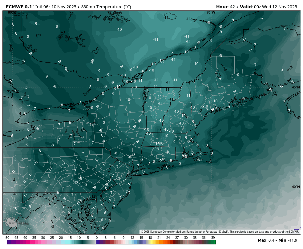
So the week ahead — our first big push of cold air is coming tonight into Tuesday. The tropics are effectively shut down at the moment, which is allowing this. The cold front is slow moving, and will take most of the daylight hours to get through eastern NY and Vermont. At its core Tuesday evening, our 850mb temperatures drop below -10°C in most of New England (image of Euro output at 7pm Tuesday on the right).
We’ll see some moderation Wednesday and Thursday with a weak wave coming in. Rain and snow showers are likely across the Northeast with this boundary. Northern VT/NH/ME resorts will keep marginal snowmaking windows during the day, and decent ones at night. The farther south you go, the windows get smaller and may be lost at base levels.
A second resurgence of cold comes back early Friday morning, settling in to its deepest point Friday night, with similar 850mb temperatures as our initial blast — with the exception of areas south of the PA/NY line. This blast is a bit more shallow in terms of how deep it can penetrate geographically, therefore PA/VA miss out on the secondary cold.
With a system approaching for Sunday/Monday (timing is fluctuating), we’ll lose snowmaking windows Sunday and likely Monday as well. Rain would be the predominant p-type for this event.