The slow roll into cooler temperatures is certainly coming to fruition. With the tropics still active with Hurricane Melissa moving into the open Atlantic, the opportunities for cold shots remain low and those that come are quick coming.
Unfortunately any time there is a strong hurricane in the models, the long range tends to become more volatile and uncertain.
My use of November 10th (in forecast discussions) goes back to when we started seeing some strong windows last season. As we touched on in summer client meetings, I anticipated the beginning of this season to be very similar to the beginning of last season, which was quite a slow start until the middle of November. We had a handful of windows in the first two weeks, but the second half of the month proved to be much better, especially by Thanksgiving.

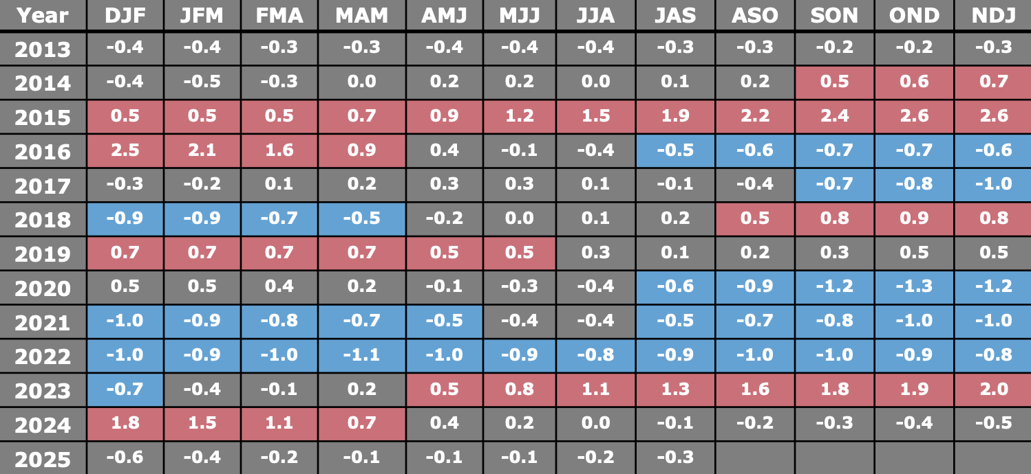
The graph above is from the Climate Prediction Center’s weekly ENSO review. While NOAA places us in a La Niña for the winter, we’re not technically in one, just like we weren’t in one last winter either. For it to be considered a La Niña period, we need three consecutive blocks of -0.5 or lower. Therefore I think we remain in this “neutral negative” pattern to start, and have a very similar start to last season.
That being said, we may have some short windows to work with this weekend at higher elevations (Saturday/Sunday), and again in the middle next week (Tuesday/Wednesday). Once Melissa exits the western Atlantic, the models should become more steady with the read of the cold and its depth — and with no other tropical systems to watch as of now, we should see the pattern turn colder by mid-November.