Several clients returned on 10/1 and another handful arrive on 10/15 to watch how October unfolds.
Some great news from NWS in Gray, ME — the twice daily weather balloon launches returned this week after moving down to one per day in March 2025. Not sure if the shutdown will affect this new development.
The elephant in the room remains the current drought situation. Despite picking up 1-3″ of rain last week, it only delayed further onset of the drought and will continue to get worse as we have another 2 week stretch of dry weather.
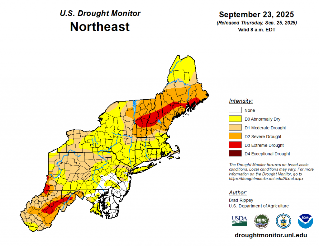
While portions of PA & NY remain less affected, the drought covers nearly the entire Northeast. The worst of the drought stems from interior VT to Downeast Maine. The key for next spring/summer will be getting enough water down before the ground freezes, though that will be a tall order. We are in a 10-16″ deficit in some areas, and have only 8-10 weeks before the ground freezes up.
There’s currently no major shift in the pattern expected through mid-month. The next chance of rain arrives on 10/8, with another break expected before rain around 10/15. Towards the end of the month, we should see enough shift in the jetstream to start bringing in more mid-latitude systems.
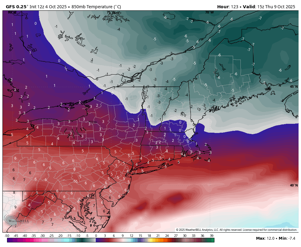
We’ll also have our deepest cooldown yet after the system on 10/8. High summits in northern NY/VT/NH/ME should drop into the 20’s Thursday morning (10/9) and remain rather cool through the day. We warm up quick, however, into the long weekend.