Not much has changed since we switched into April, now that we are heading into the middle of the month. The pattern remains quite unsettled, overall on the cooler side, and a sunny day is a hot commodity.
While we enjoy some sun for Wednesday and early Thursday, the clouds come back in during the day Thursday ahead of a series of energy impulses swinging in Thursday night through Tuesday night before a cold front comes through. There will be breaks in the precipitation (and perhaps briefly in cloud cover) between these individual pieces of energy, but overall unsettled conditions remain.
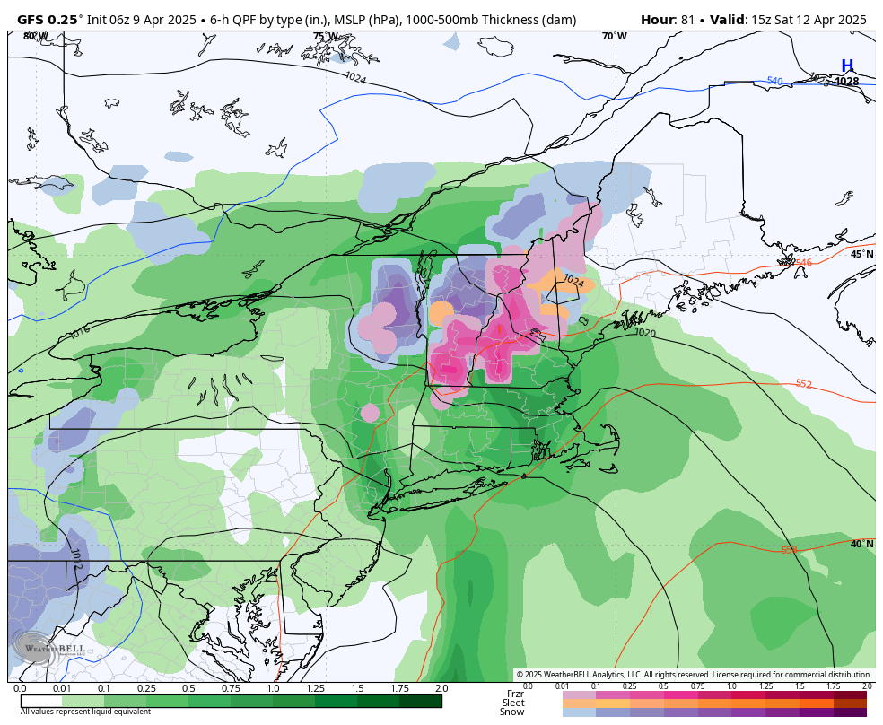
In this time, some areas will be cold air dammed, therefore mixed precipitation or light icing is possible, mostly late Friday night into Sunday morning (image shown is Saturday at 11am). Wind may get a bit gusty Saturday in areas where damming breaks. Moving into Sunday, most of us should pop above freezing through the frontal passage Tuesday night with more showers possible. Behind the frontal passage, upslope snows may bring another hearty blast of snow to the favored slopes.