Despite having the ingredients for what should be wintry events, the time of year is having an effect on the outcome. The negative NAO can’t hold in enough cold air for the storm this week, even with a trending positive PNA.
We’ll have a cold front move through tonight, dropping temperatures into Tuesday morning (though some may not feel the cold until Tuesday night as the daylight takes over). Wednesday is seasonable to seasonably cool as we cloud back up ahead of the next system.
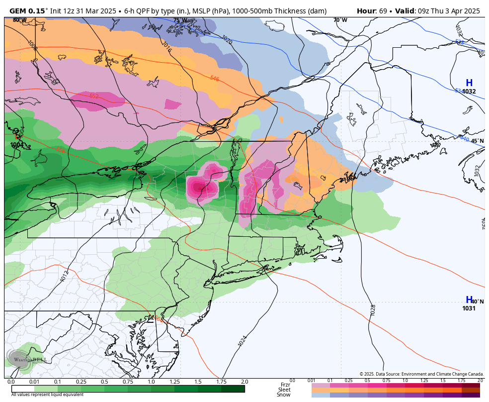
We start out as snow Wednesday night in many locations central NY and north, but quickly move to sleet. Warmth kicks in from southwest to northeast as cold air damming breaks, first changing everything to freezing rain and then plain rain. For resorts remaining open this week, the rain part of this storm system is fairly short lived as it’s a quick mover – though it may still put down .50-.75″ of rain quickly Thursday morning.
Because another system moves in so quickly, there’s not much of a cool down. Therefore behind the rain, there’s no flash freeze.
Instead we have another system, which currently looks very disorganized, coming in for the weekend. There is little agreement on this one except that there’s a stalled boundary — but the level of cold and the progression of the waves of precipitation is harder to discern at the moment. Some snow is possible, but the details are not yet clear enough. All to say, it doesn’t look like a bluebird weekend ahead.