As nice as January and February were, it was a struggle to enter March without much break from the warmth along with numerous rain events and ill-timed flash freezes.
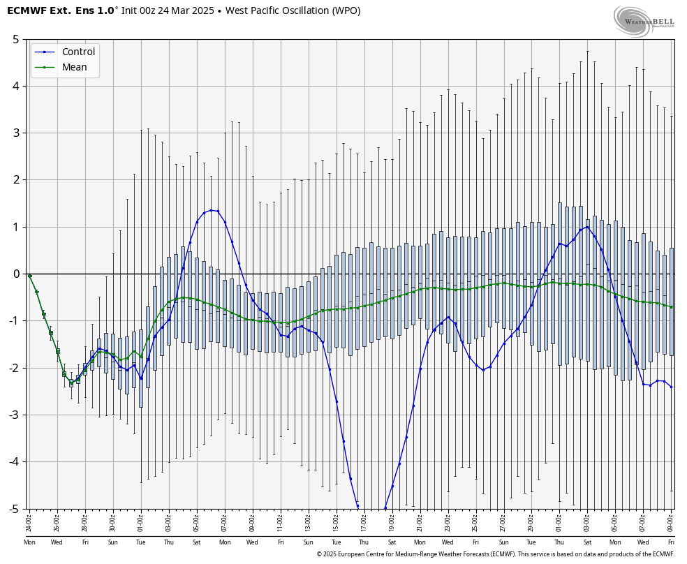
We finally made it through the 20-25th period of transition and are now squarely in a negative WPO scenario through most of April. The stronger sun isn’t on our side and the snowpack has lessened but we have a bunch of winter left for New England and some points south.
The storm system yesterday delivered nicely into NH & ME but unfortunately was too disorganized initially to give much into NY/VT. The upslope snows helped out the typical favored locations into today, and we’ll continue to see those through this evening. We also have a few weak waves of energy bringing rain/snow showers both this afternoon and Wednesday afternoon which could bring some minor accumulation.
As many of us look forward to true spring skiing and spring events, there’s some concern for this upcoming weekend in terms of the dreaded I word — icing. Cold air is in place after we cool off more into the end of the week, and a front nearly stalls over the area with several waves of precipitation moving along it as cold air damming sets up firmly.
The concern is during and in between these precipitation flows, as drizzle/mist can accrete very efficiently, especially in the overnight. A saving grace may be that we start as snow briefly, but once the buffer of snow is lost, icing may be significant and impactful for central/northern NY, VT, NH and ME. The Mid-Atlantic, Catskills, and Berkshires will likely see mostly rain out of this one.
I like the Canadian for this scenario — it’s very similar to the Euro but holds the damming and icing on a bit stronger, which I am leaning toward. Damming is typically underestimated and in an overrunning situation, it’s usually more on the freezing rain end of the spectrum when it’s eroding.
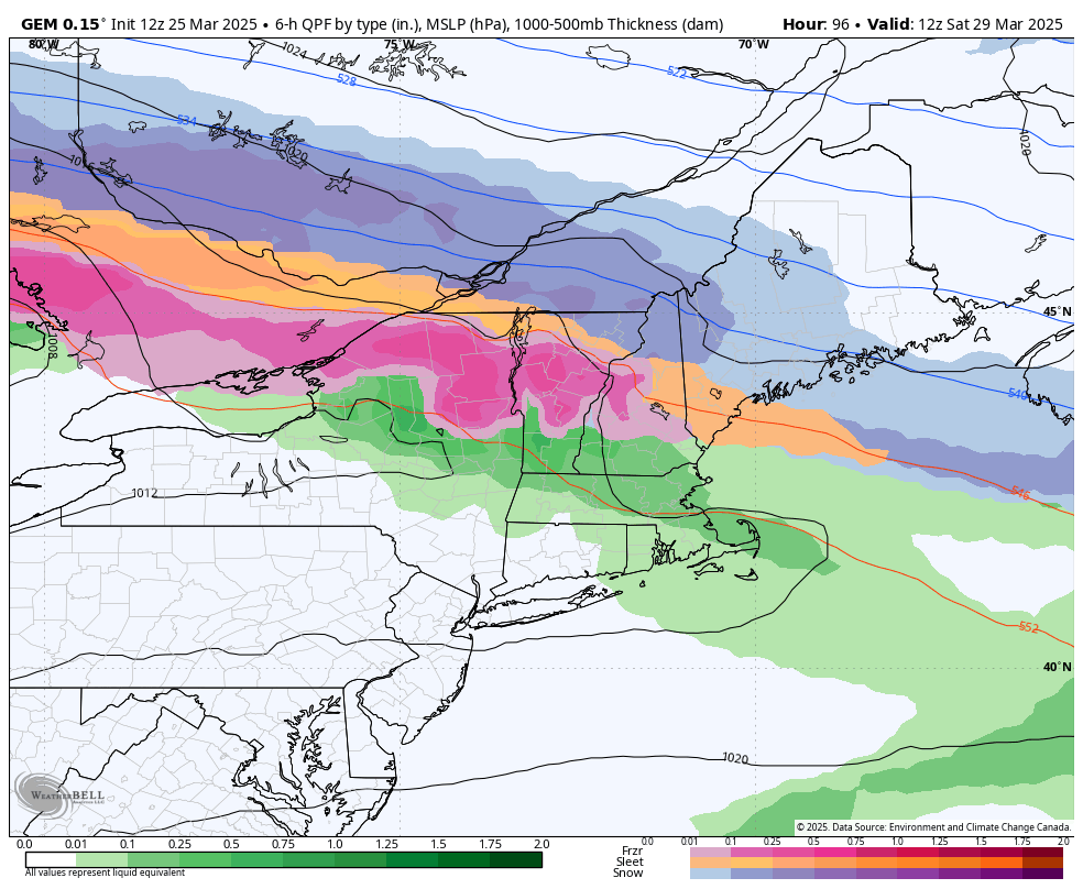
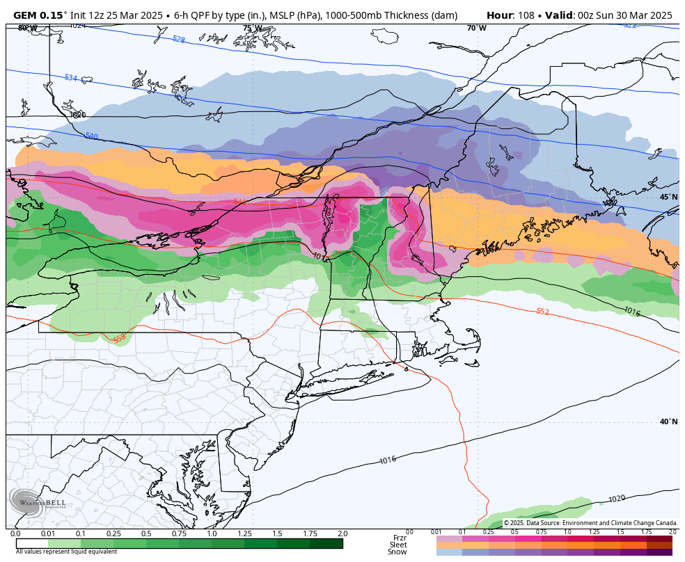
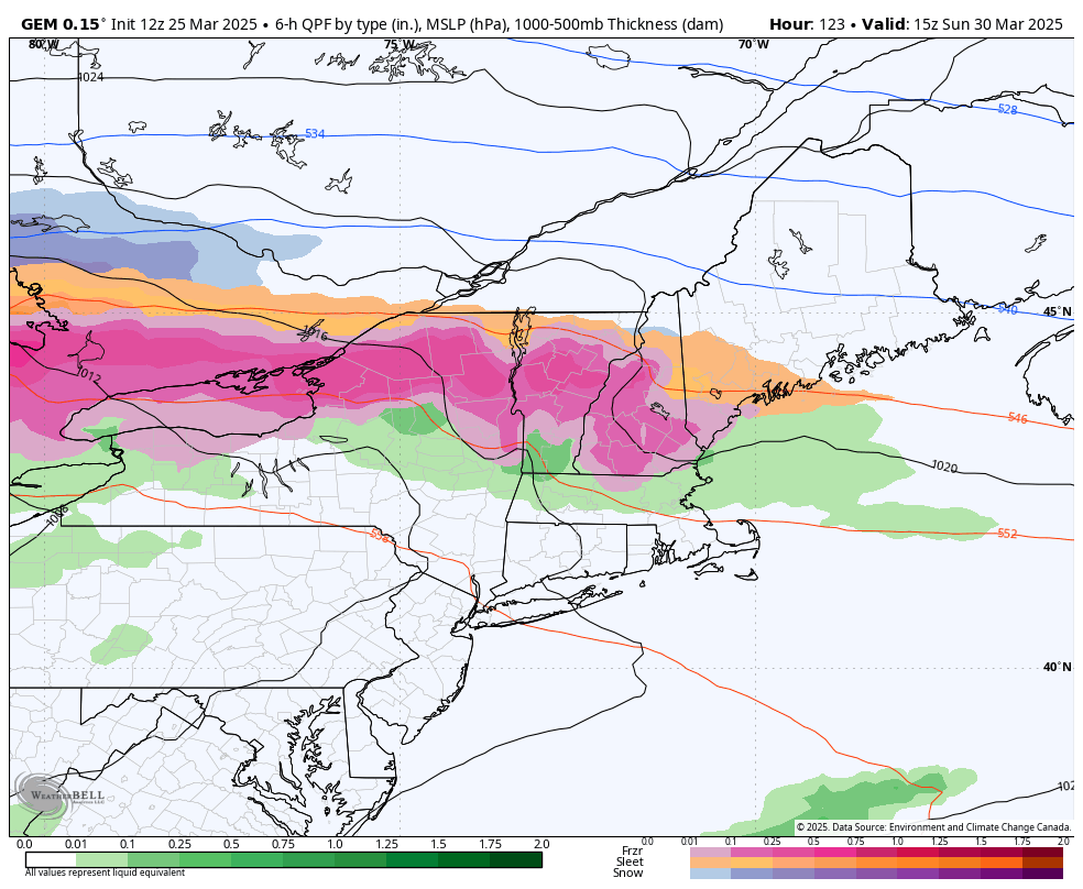
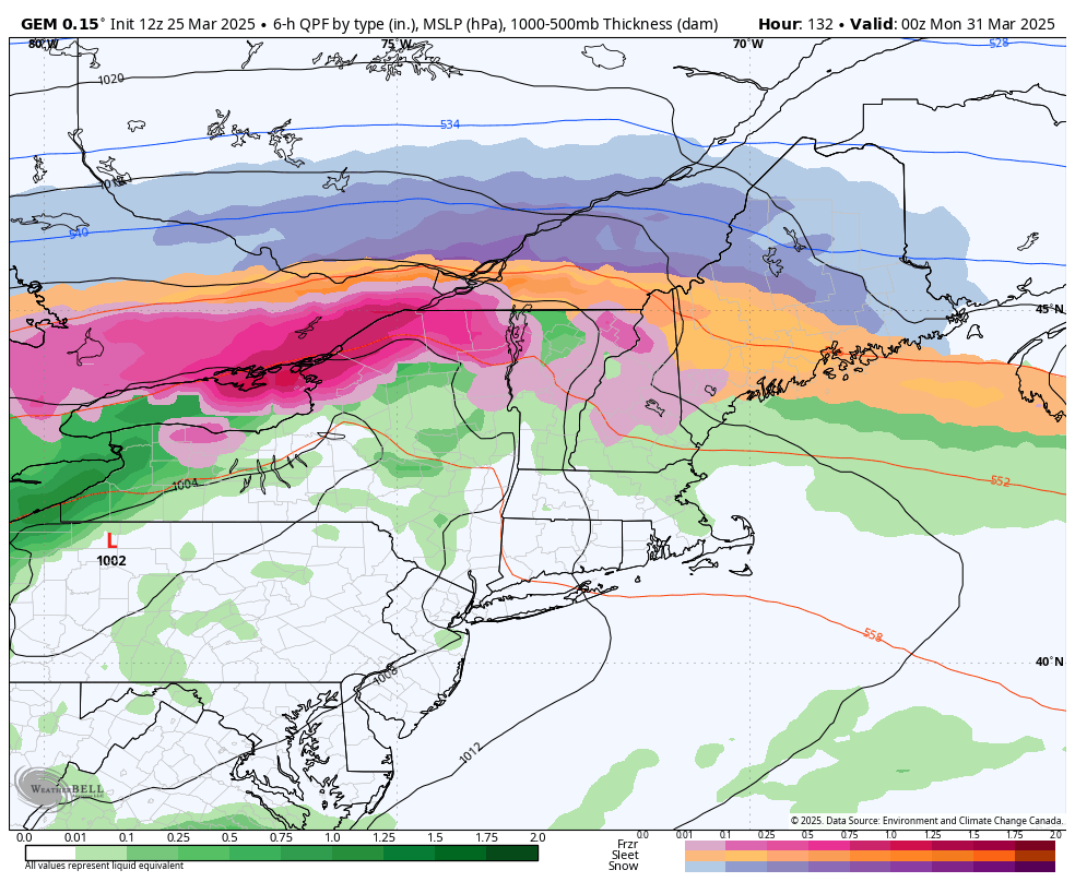
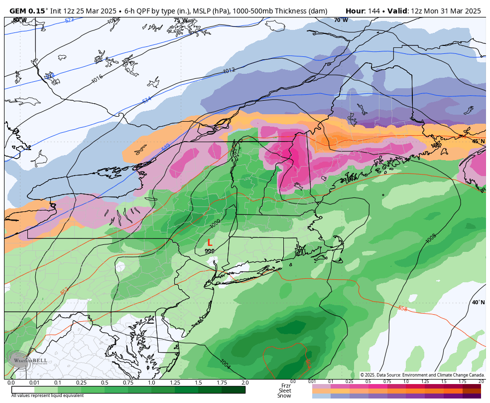
This is Saturday at 8am to Monday at 8am. Some areas are looking at icing for nearly 48 hours. This is a recipe significant icing and by the time we warm up on Monday afternoon, it’s likely too little too late for any help.
Now there is time for this to adjust and move, however it’s oddly consistent across all models – the cold start, the stall and prolonged icing threat.
There’s even another wave that may develop along the boundary and develop a coastal low on Tuesday 4/1 (no joke), but I’m going to hold off on delving too far into that scenario at the moment.
In terms of temperature, there’s only one warm day to look out for — Sunday/Monday (depending on how the timing flushes out). That’s the moment when cold air damming breaks but the front has not yet gone through. We could see 60’s in the Mid-Atlantic, 50’s in the Catskills and 40’s & 50’s in the southern Greens briefly before we drag the cold air back in. North of that…you’ll only see those temperatures at elevation. The cold air damming will be strong enough to temper any warmth before the cold front comes through.
Beyond this, there’s another storm signal for 4/3-4, but that will likely ebb and flow on the outcome of the beast above. NAO will be negative, AO trending negative, WPO negative and EPO positive. That is a decent setup for a coastal storm, especially as sea surface temperatures in the equatorial Pacific continue to rise. The Niño 3.4 region departures snuck into positive territory last week, and while they went back down to -0.1 this week, the effect of that would likely be felt next week (takes about 2 weeks for changes in the Pacific to translate to the atmosphere). March will go out like a lion and April will prove to be an active weather month, to say the least.