
Since our last blog, I’ve been watching the long term pretty closely as we progged March 20th as somewhat of a turning point of our first substantial warm period of the season. The teleconnections continue to paint the picture of the change but the deterministic runs have not — ensembles are a bit better so I’m continuing to run with the fact that winter is not over. There’s always a meme out there that speaks of a “false spring” or “spring of deception” in late winter…and I think this is just that.
There’s overwhelming agreement across all ensemble models of the WPO tanking into negative territory around 3/24-25. The WPO was a clear indicator of cold earlier this winter.
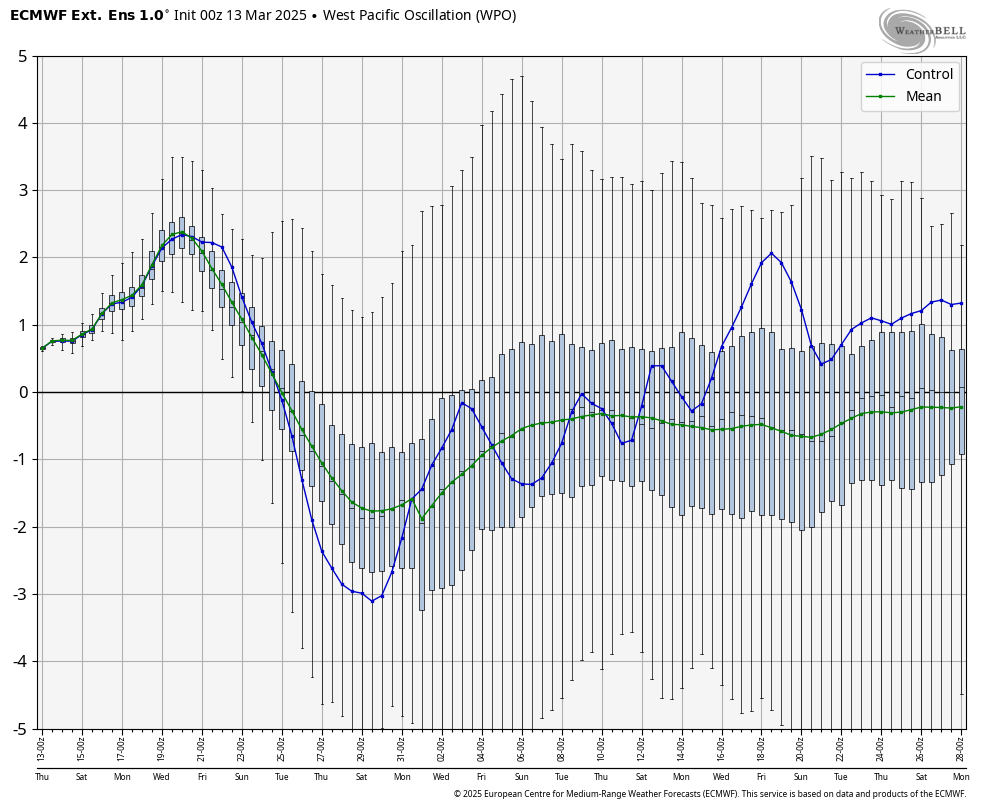
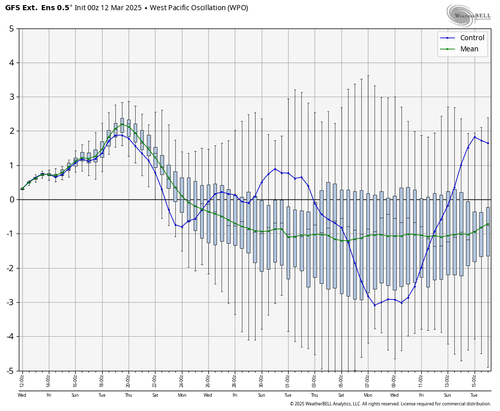
The difference of course now is that we have the extended and longer sunshine to contend with. However, this is a pretty clear tank from the current pattern and it stays with us through mid-April, at least. EPO also goes negative into the this time frame, along with AO/NAO.
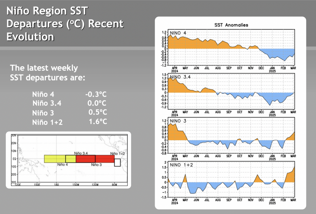
Too little too late potentially, but I do think a doozy of a coastal storm is still to come. The SST anomalies have hit neutral territory for the first time since mid-November. That wasn’t a terrible time for us — the Thanksgiving storm was the biggest large-scale storm for many of us this season. The coastal storm pattern should start to build as traces of La Niña continue to diminish.
So the big question remains — what is coming before winter’s last hurrah settles back in, and is it too much warmth to contend with?
Perhaps, and will definitely be location dependent — we have a couple warm days and two rain events to get through before we can get to the finish line of this air mass. Sunday and Monday feature temperatures in the 50’s and 60’s with about an inch of rain falling. Combine that with southwesterly winds, and we have a terrible combination of snow-eating weather conditions. We crash quickly into cold Monday night/Tuesday morning, but it is short lived. Potentially the warmest day of this entire period comes Wednesday with widespread 60’s expected. Thursday (3/20) starts warm before the boundary comes through.
A strong cold front comes through late Thursday or early Friday with more rain, but behind this is the first punch of truly cold air to return. A final storm/front likely comes in around the 24th/25th, which is when nearly every teleconnection plummets to a negative value.