
Late January into February was a fairly snowy and cold blitz from the Mid-Atlantic to New England. It’s been a winter that’s officially wintered — which I don’t think we can say has happened in quite a few years. Tomorrow, March 1 begins meteorological spring. Despite the snowy start that some of us will have Saturday morning, temperatures have been on the slow upswing through the last week.
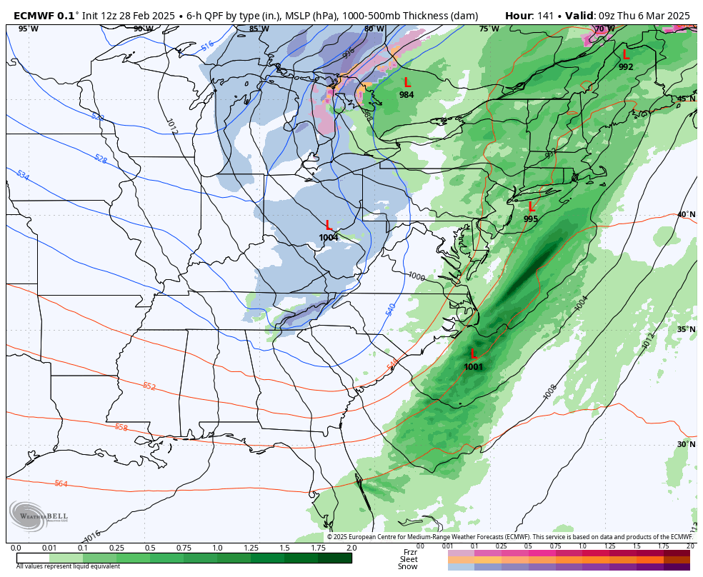
March looks to start out tumultuous — the old adage of “in like a lion, out like a lamb” for this transitional month may be at least half right. We are coming in on a rollercoaster ride of some warm days, hard cold crashes at night, potential rain events (March 5-6, pictured) followed by more cold crashes and warmups.
I saw quite a few of you at NSAA in February and we spoke briefly about the end of the season. Given the lack of a warmup in early February, I figured it would come late February or into March. It’s hard to call what we’ve been seeing a warm up in most areas, because it’s been rather tempered and doesn’t hold on very long. My hunch is this rollercoaster rolls on through mid-March.
What exactly does this mean?
New England (plus northern NY, Berkshires)– if you averaged the temperatures out, they’d probably fall near “normal” but slightly below. We’re going to have days with temperatures in 30’s & 40’s followed by the teens. Topsy turvy with some rain and snow chances alike, and some not-so-nice freeze thaw cycles.
Mid-Atlantic (southern NY) — we’ll probably start to see temperatures come slightly above average consistently for the first time since December. The warmer days will be quite warm, 50’s or 60’s. Cold blasts will be quick, and most storms will be rain, though it’s possible we mix to start.
What about the second half of March?
We started seeing (what we can barely call) La Niña shift in the last 2 weeks.
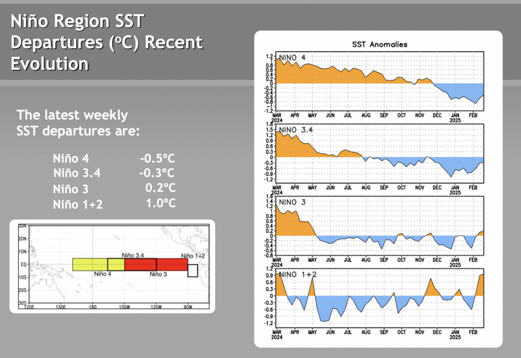
For the eastern Niño regions, this shift was dramatic — not so much for the western, but it’s a clear movement up. It typically takes 2-3 weeks for ocean patterns to translate into atmospheric patterns. Given that we’re quickly pushing into neutral or even weak El Niño in the eastern regions, I believe the storm pattern really begins to pick up in the second half of March.
This season has been filled with clippers, regional influence snows (lake effect, upslopes) and quick moving coastal lows. There’s been no blockbuster, blizzard raging nor’easter to speak of, and that’s what we often lose without El Niño influence.
Models also have the WPO starting to go negative around March 20th, which was a clear sign earlier in the winter of cold returning to the east. But if we can’t get the cold in, then we’ll end up with rainy coastals, which clearly is not as exciting.
All this to say, while early to mid-March may not look initially like the “miracle March”‘s of the past, the end of the month into April could prove to be quite interesting.