It would be nice to get through a holiday week without the dreaded ‘R’ word, but alas, it won’t happen this year….although we made it through the majority of the full holiday week with awesome weather!
In full transparency, the inversions/dry air aloft have been tough to forecast over the last 24 hours and it’ll continue with us for the next 24 hours. Dry air aloft is tricky because it causes erratic temperature movements as humidity levels fluctuate, which can sometimes move as much as wind speeds. The level at which the dry air propagates can also shift with terrain, therefore it can hit the upper levels, and move to the mid-levels, etc. Our inversions have also been incredibly deep and drastic — some 30-35 degree differences from base to summit this morning, with temperatures dive bombing from 2pm onward into the overnight. I always say forecasting a 30 degree temperature spread is similar to forecasting a 40″ snowfall — it’s a high bust potential forecast… so I tend to try to smooth it out a bit without losing the vertical structure of the temperature profile.
Moving on to the weekend, we have the not-so-nice weather to chat about.
For Saturday, there’s no real area of organized precipitation to contend with, but I think we’ll deal with drizzle/freezing drizzle across the southern New England and into Vermont. The terrain may block it getting into NH/ME but we’ll certainly be clouded over.
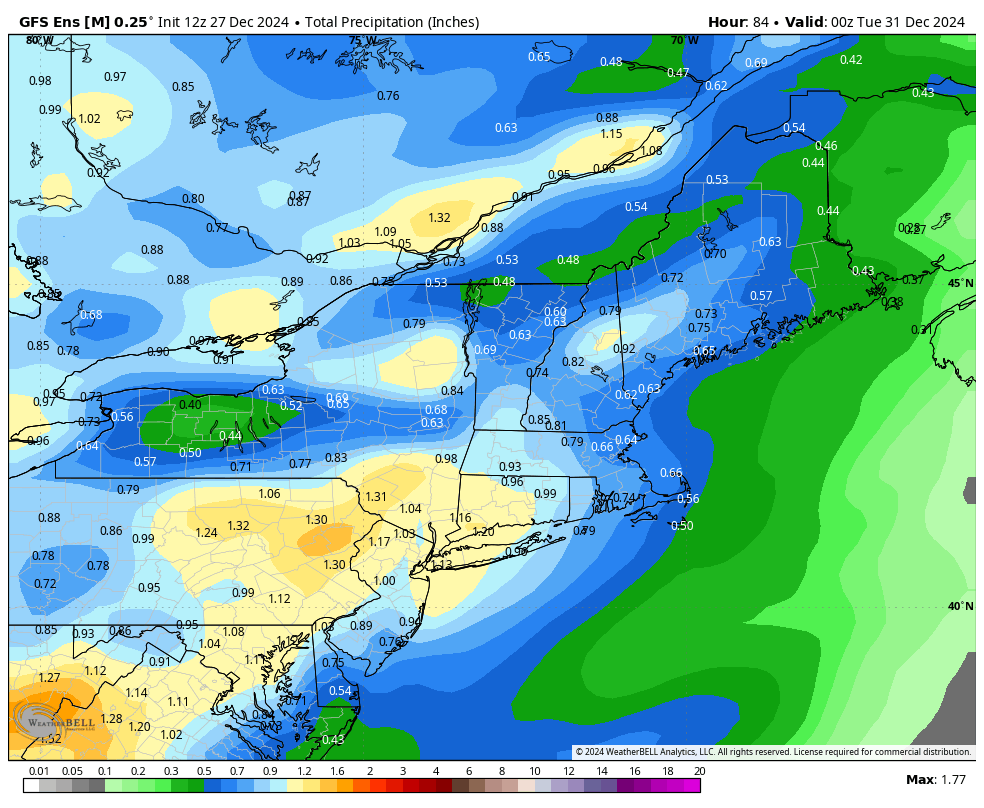
From there we bring the first of two systems in later Sunday, first with the warm front which may lead to some freezing rain initially as cold air damming struggles to hold on in northern NY/VT/NH/ME. Any ice will change to rain as the warm air wins. All rain expected in the Mid-Atlantic. Once the warm front passes through, we’ll briefly boost temperatures in the warm sector before the next batch of rain comes in with the cold front overnight into Monday morning. Some showers may hold on Monday as well. Total rain should stay close to or less than 1″ total.
The next system arrives on New Years Day and it’s a little harder to pinpoint at the moment due to a couple factors. First, the precipitation type is shifting based on low position. Second, because we have cold air coming in behind the system Sunday/Monday, it may hang on enough to keep frozen precipitation for the Catskills and north – but the level of this cold isn’t being handled well at the moment. Finally, with two systems so close together in time, sometimes their strength are mismanaged in the models. We’ll have a clearer picture come Monday.