Temperatures come down slightly tonight and Wednesday with a brief pass of a low pressure system Wednesday night. This brings rain to the Mid-Atlantic, a rain to snow transition in the Catskills and mostly snow elsewhere. Accumulations should be fairly light (2-4″) but with the cold coming Thursday, it does guarantee a white Christmas for most of New England.
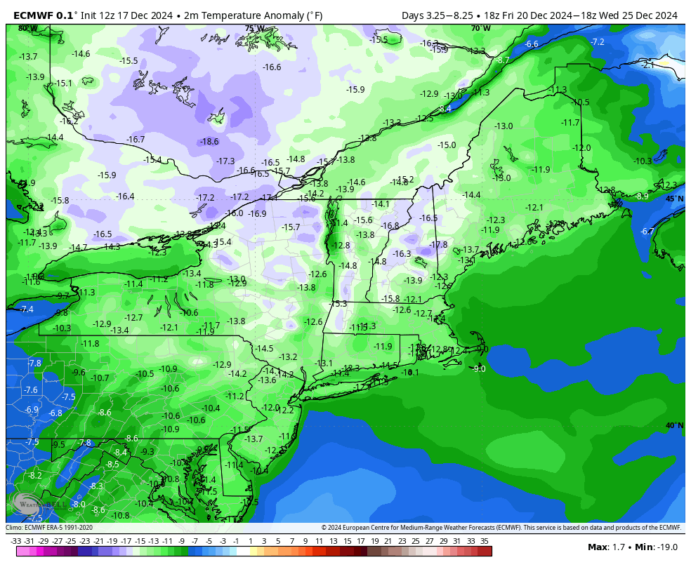
I’ve posted the 2m (surface) temperature anomaly in Fahrenheit for the 5 day period of 12/20 to 12/25. We are talking 10 to 15 degrees cooler than normal in most areas.
Temperatures range from the single digits at points over the weekend in New England to the 20’s for the Mid-Atlantic.
Clouds also hinder much movement in temperatures as there’s a coastal low forming offshore 12/21. It’s possible some energy traverses back toward the east coast which brings light snow or flurries to the Northeast.
This wouldn’t be anything substantial, but the cloud cover does keep it cool, and preserves our snow cover.
There’s a couple small pieces of energy that have been floating around the computer models from 12/24-12/26. No large storms expected, but we could see some extra snow showers in that time period as we also notice an upward movement in temperature.
Going a little beyond Christmas, temperatures do moderate from the depths of cold from the weekend. I call this somewhat of a “re-energizing” process, which is necessary for us to have cold spells and not completely flip the other way. Though we’re warming from 12/26-12/30, it doesn’t look active in terms of precipitation until around 12/30. This should break the warming trend, so my hunch is it’ll be a larger event rather than a small piece of energy. Cold then resettles after that storm system.