Behind the wind and rain tonight, we’ll have a hard crash in temperatures into Thursday through the early weekend. The pattern adjusts and begins regeneration – starting today and ending in about 7 days.
That doesn’t mean we’re going to see warmth that entire time — but we’re on the roller coaster ride of cold, followed by warmth when precipitation comes in, and back to cold. It’s a bit of a La Niña-esque pattern, even though we’re still ENSO neutral.
We start to see temperatures moderating again on Sunday, with some mixed precipitation and rain coming for Tuesday and early Wednesday. This will be substantially less rain than what we’ve seen today, but more liquid nonetheless. We cool back down again after, and this should be the shift to more of that overall cold pattern we saw in late November/early December.
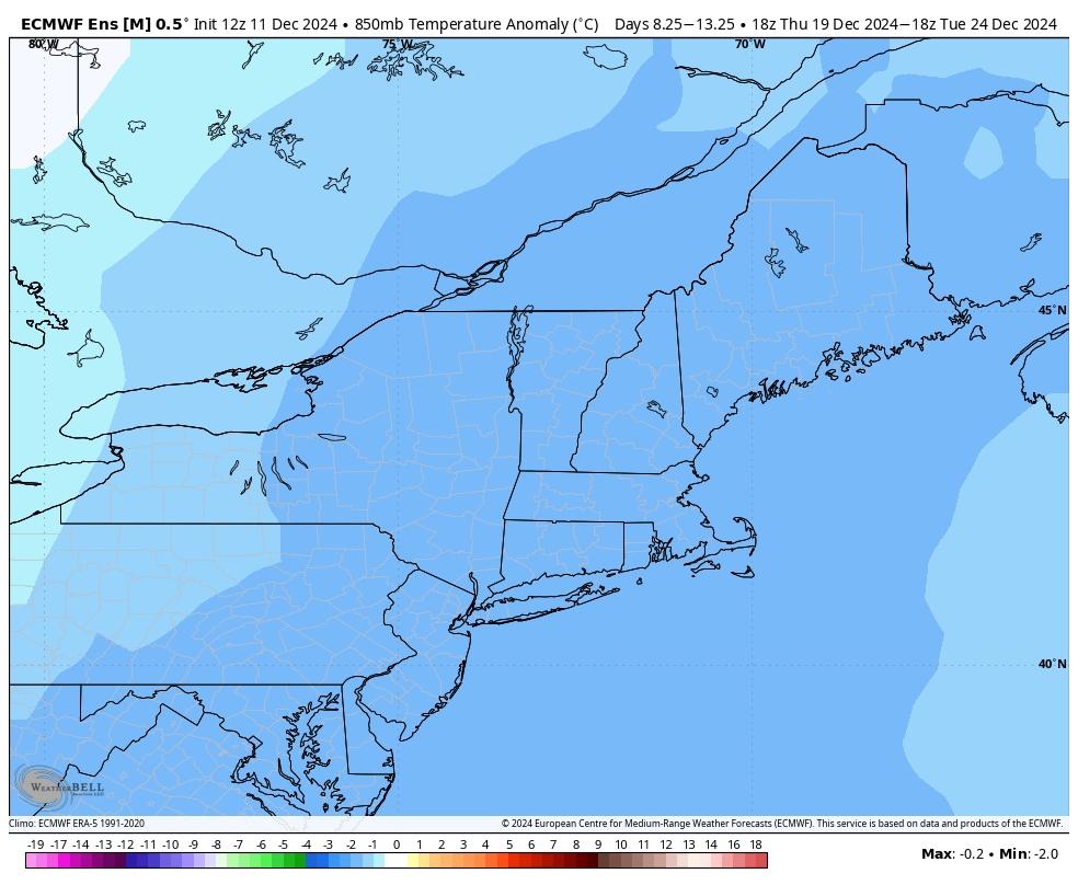
Coming toward Christmas week, it does look like there’s going to be colder pattern in place (as of now). Shown is the Euro Ensemble of 850mb temperatures for the 12/19-12/24 time period. They are running colder than normal for the week leading up to Christmas, roughly 3°C cooler.
The precipitation anomaly shows no trend to dry or wet in that time frame, therefore it’s still up in the air as to whether we’ll have some natural snow to add to the cold. The Euro has a storm signal around 12/21.