If you’ve been around teenagers in the last year, you’ve probably heard the term “full send” — so I’m deeming this week “full send snowmaking” — we have lots of opportunity, often times through the day, all the way through the weekend.
This may vacillate a bit more in the Mid-Atlantic as we have more overnight windows and we lose the cold midweek with the low pressure, but the windows do come back behind the clipper.
The midweek system is our only real precipitation of the week, outside of continued upslope snow showers in Vermont and northern New York. It’s not that exciting in terms of accumulation, and if you get over 3″ out of it, consider yourself lucky. However the upslope snows along the Greens & Adirondacks may be substantial. Easily over 6″ possible in the usual areas in the NEK & NY (and these typically overproduce so 12″ probably not out of the question).
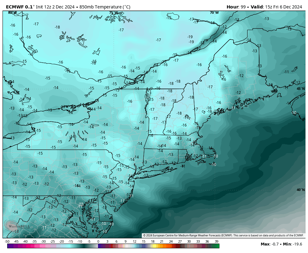
Behind the Alberta Clipper comes the coldest air of the season thus far, the core of witch settles in Friday morning through the weekend (image of Euro 850mb temperatures shows this core).
We begin to lose the cold quickly on Monday. Just to note, there was a bit of a discrepancy between models this morning – if we would lose cold Sunday vs Monday – and I hedged my temperature forecast to the earlier departure of cold given there was a system approaching. However, this evening, there’s more of a consensus on a Monday departure of cold, so you’ll notice this change in the forecast Tuesday morning.
We are anticipating some non-snow events and warmer temperatures next week. This is not out of the realm of normalcy given the relative stretch of cold we’ve been in with our pattern change beginning roughly 3 weeks ago…at some point the pattern has to recharge if it’s going to be sustainable. As of now, the Euro Weeklies bring the eastern trough back into play around 12/18-12/20.