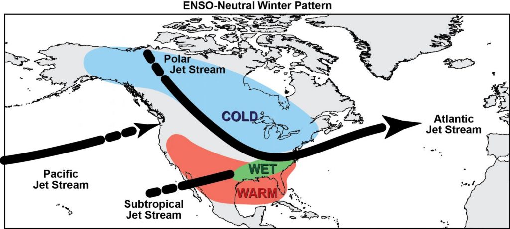
It’s the second week in a row of seeing 70+ degrees across many areas in the Northeast. However, right now most of our patterns are being influenced by the reactivated tropics, as we continue to see a neutral ENSO cycle take shape. Most tropical activity shunts cold spells to the north, or keeps them quite shallow.
In terms of where we are in the ENSO cycle, we’re still solidly in the neutral phase. The August/September/October ONI was -0.2. It’s still expected that we get into the weak La Niña, but typical neutral patterns tend to be better for storm tracks in the east.
An item to take into consideration when looking at model data this time of year, is anytime the model may spin up tropical activity, the long term is inherently skewed with convective feedback and tend to swing wildly run to run (I noticed this especially on the 12z GFS today for the 7-10 day range).
So let’s chat about the couple of cold shots that we have in the pipeline (potentially).
The first is this weekend — it’s quick moving but deeper than initially depicted. The GFS had this fairly strong last week, though weakened it over the weekend and now has come back around. The Euro has stayed rather consistent with the strength, and that seems to be the pattern so far this year (GFS sees it first, then backs off, other models see it, and then GFS comes back on board).
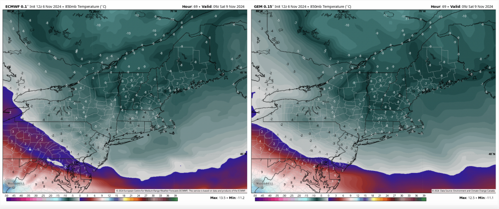
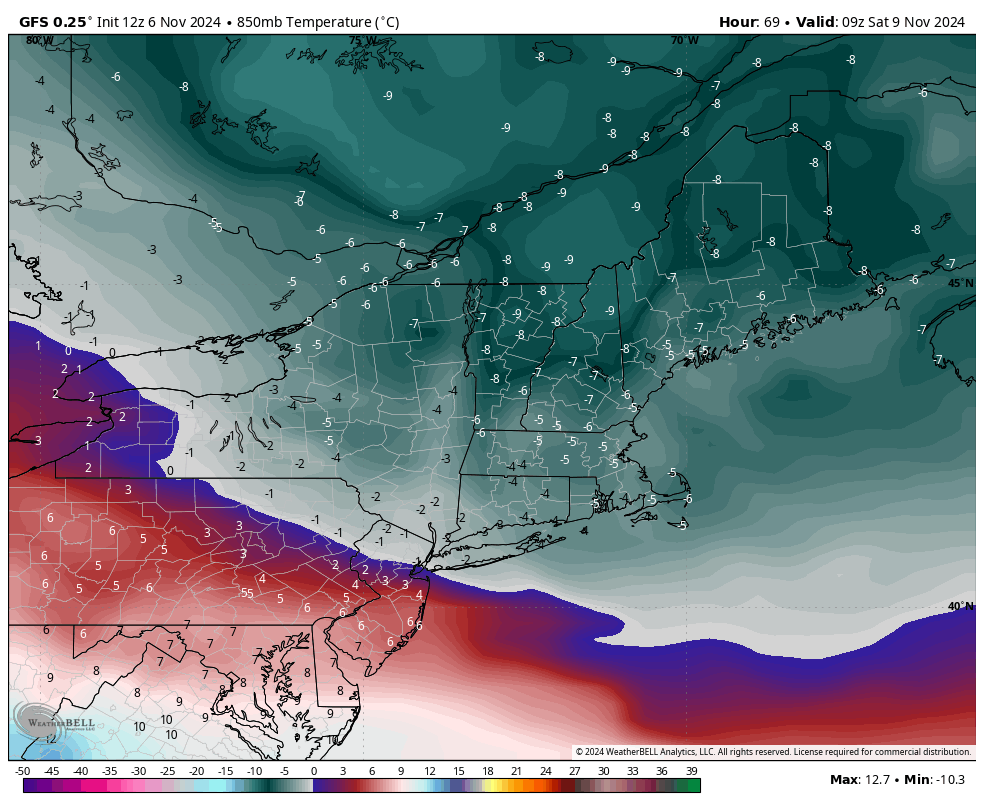
I’ve posted the Euro and the Canadian 850 mb temps for the deepest point of the cold for Saturday morning. The Euro has been consistent with this air mass and the Canadian sees cold depth better than most other models. They are quite similar in pattern and strength as well. The core of this cold will be in around 4am on Saturday, but quickly moving out.
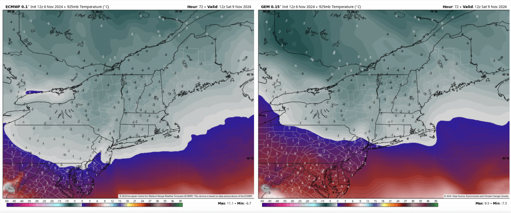
The deepest point in the mid-levels or lower summit elevations is around 7am — above is the 925mb level. This cold will be quick hitting but will have deep cold within it. It’s possible some windows extend into Saturday night at mid or low levels where the cold takes longer to retreat (inversions as well). Timing of the retreat highly depends on the speed of the clouds coming in ahead of some precipitation later Sunday into Monday. Higher elevation areas (>3,000ft) may have 12-18 hours in this window, with only 3-6 hours at the lowest elevations for areas north of the Catskills.
Beyond this window, there’s a discrepancy in the Canadian/Euro and the GFS, as we’ve been seeing. Earlier this week, the GFS saw a cold burst around the 12/13th, but has since back away as it’s developing a tropical cycle in the open Atlantic. The Euro/Canadian have been on this potential window harder but still with some inconsistencies. Ultimately it does depend on the tropics and what may or may not develop.
Another block of cold air is being picked up on around the 15/16th by the Euro/GFS but with little consistency. As long as the models toy with tropical activity, the long range will be tough to pin down.