
A couple things to touch on as we come out of the coldest stretch we’ve had so far..
But first a quick look at the rest of the week.
Moderation begins Tuesday though we’ll really feel it into Wednesday — especially in southern VT/NH and New York as a warm front works its way north. We should also get a few showers, possibly actual light rain as the warm front creates some overrunning. By Thursday everyone’s getting close to or surpassing 70 degrees for quite a warm Halloween. While a cold front comes through Friday with a couple showers, it’s not nearly as deep as the previous cold air mass.
One of the positives in the short to long term is that the tropics have been quiet for about a week now. There’s quite a steep drop-off of activity in October and especially November as sea surface temperatures (SST’s) begin to cool. In addition, La Niña has still struggled to come to fruition, and that was supposed to be the major driver of an extremely above average hurricane season. While there were many devastating storms, we did not hit the numbers NHC predicted.
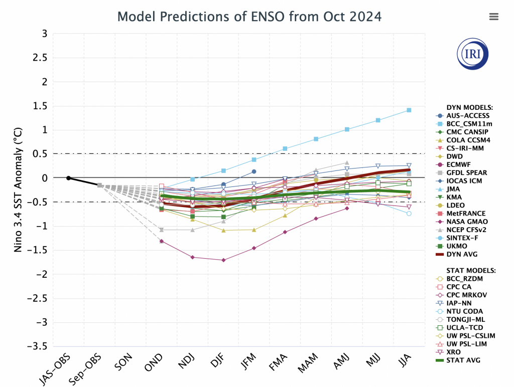
If we had client meetings in July, we had some fairly depressing conversations about the early season as La Niña was projected to hit a moderate level for late fall. Below I’ve posted the June & October forecast ENSO cycles from the International Research Institute For Climate and Society out of Columbia. The Climate Prediction Center uses their predictions consistently.
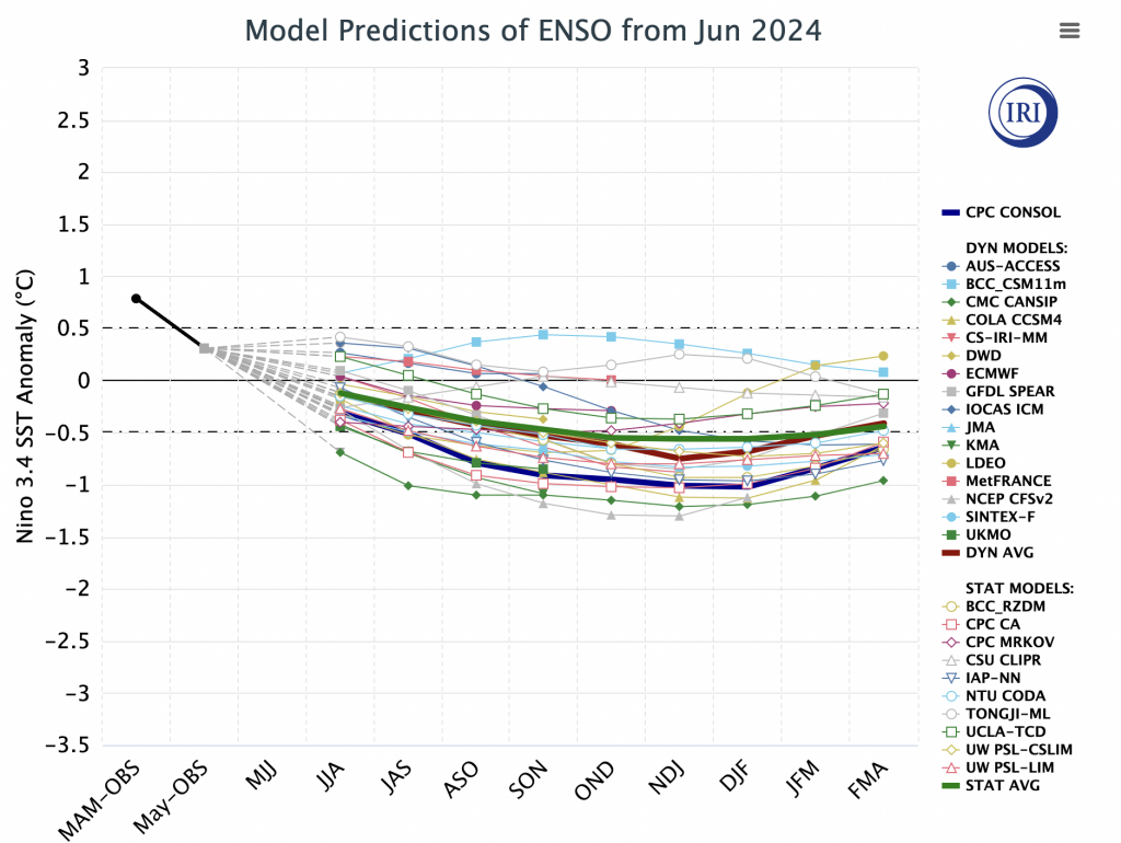
There were very few members in June that predicted 0 for the observed Niño 3.4 region SST anomaly for JAS (July/August/September), as most were diving us into a La Niña by that time. It was the GFDL Spear and UCLA-TCD that had the closest readings.
If we isolate those two, here’s what we see for the next 12 months.
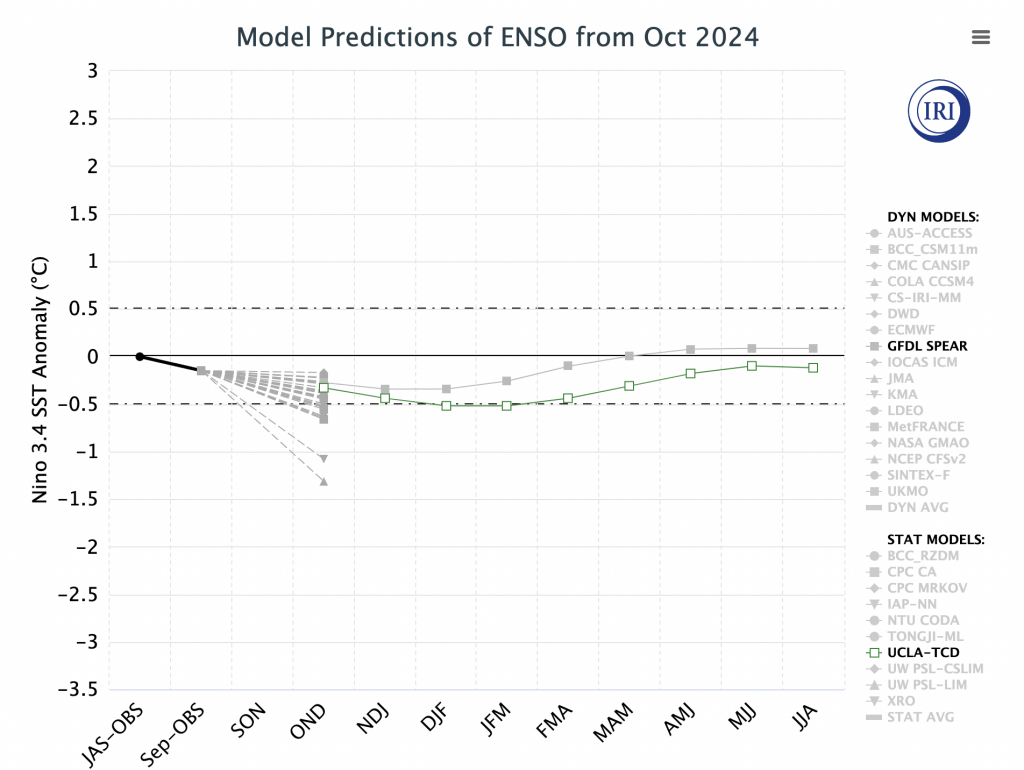
Both of these have a similar trajectory, with the UCLA model just sneaking us into a weak La Niña whereas the GFDL keeps us in a neutral phase. Interestingly enough, one is a statistical model (potentially biased to climatology) and the other is dynamical, which tend to be more accurate. All this to say, the initial thoughts of an established weak La Niña, borderline moderate is now borderline weak to neutral. This is a better outcome, typically, for the winter season in both snowmaking and natural snow. What this allows is for regional patterns to have more impact, and there’s no overarching global pattern influence. Movements should be a bit gradual and it’s unlikely to see a winter of extremes.
The last winter we saw a neutral to almost weak La Niña phase was 2013-2014, though we came out of another neutral winter (closer to weak El Niño though) in 2012-2013. The closest winter analog to coming out of a strong El Niño winter to a neutral/weak La Niña is 1992-1993. However, in that winter we started to see rising SST anomalies in early 1993 (which likely helped create the Superstorm), where we should see that in late spring or early summer 2025.