A little behind on the long term update as we’ve been dealing with power/internet outages since Thursday morning.
Overall the long term is on the seasonable side. I thought we would shift back toward a cooler pattern after April break, however the teleconnections have shifted to staying more neutral rather than going into phases that looked cooler.
This may impact the last few weeks of the season as a weakening El Niño would yield more rain events, and there’s not much cold air to work with.
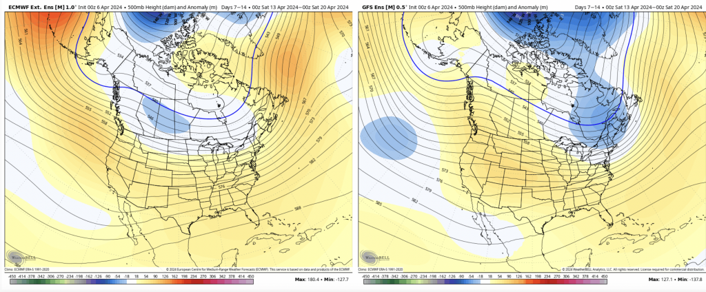
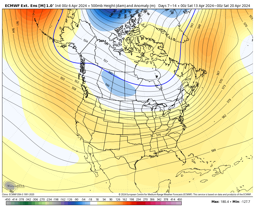
The pattern gets slightly cooler for Days 7-14, but it’s not as exciting as I thought it could be last week. Looks like we could have another omega block setting up as well per the GFS.
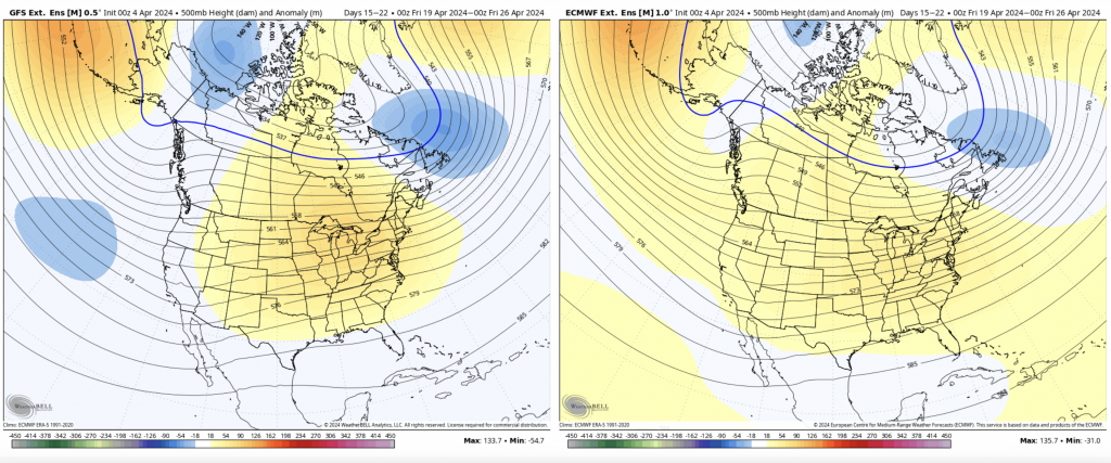
By Days 14-21, the ridge looks to shift slightly to the east but still centered over the Great Lakes. With the shifting ENSO cycle/global patterns, it’s not surprising to see the pattern stalling out. The GFS shows some very mild Omega block signs continuing. No major anomalies to note in this time frame.