Here we go again…
We have a reading of 1.0 out of the Nino 3.4 region this week (which is where the ONI is derived from ), which means we are squarely in a moderate El Niño phase at the moment atmospherically (it takes a couple weeks for the global patterns to shift). Keep in mind that a weak El Niño is still just as exciting as a moderate one for storms, almost more so because usually in a weak phase, the lows are farther south so there’s more cold air availability — typically. We’re nearing the end of big winter storm season by the time the cycle recharges, so it will be interesting to see it all play out.
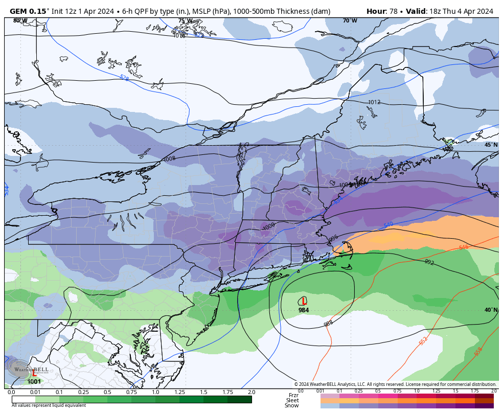
We’ll begin to clouds up Monday night into Tuesday ahead of the next doozy of a snowstorm.
There’s a lot of components to this storm, the most important being low placement, and the affect of the negative NAO on the movement of the low. As you may be watching runs come in from the models, that’s the biggest difference-factor. The GFS has a full blown stalled low right into southern Maine, whereas the Euro stalls it off the coast of Midcoast Maine before it meanders inland. The Canadian has the strength of the GFS but the placement of the Euro. However, as the ensembles below show, the Canadian looks more like the GFS. Hopefully the oz data can shed a little more light on the upper level dynamics at play. I’ll be putting out first call snowfall totals in the morning update.
Therefore I’m going to leave the ensembles as the visual today…as run to run numbers are varying drastically. This is valid through 2pm on Friday.
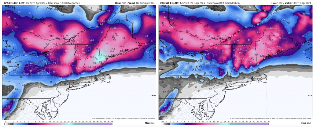
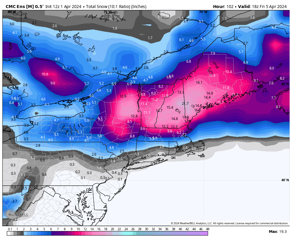
I look at these as “safe” numbers. These are at a 10:1 ratio, and though this is a much wetter snow storm system than the last, we’re still looking at better than 10:1 in most areas. Areas of concern for mixing or less than 10:1 would be closer to the MA border in VT/NH and south, and anywhere within 50 miles of the coast.
Wind is also a big component with this system as we have more of a due east or east northeast direction rather than a true northeast. Blow downs and power outages are a major concern.
This system does stall for a while after the main event, with rain and snow showers potentially lingering into Saturday. We begin to warm up on Sunday with a more spring like feel to the weather next week.
Currently, eclipse weather looks very promising.