We’re entering back into more of a winter like pattern as El Niño drops down to more of a moderate phase. However, with March comes a stronger sun angle, and therefore we’re inherently running warmer in storm systems.
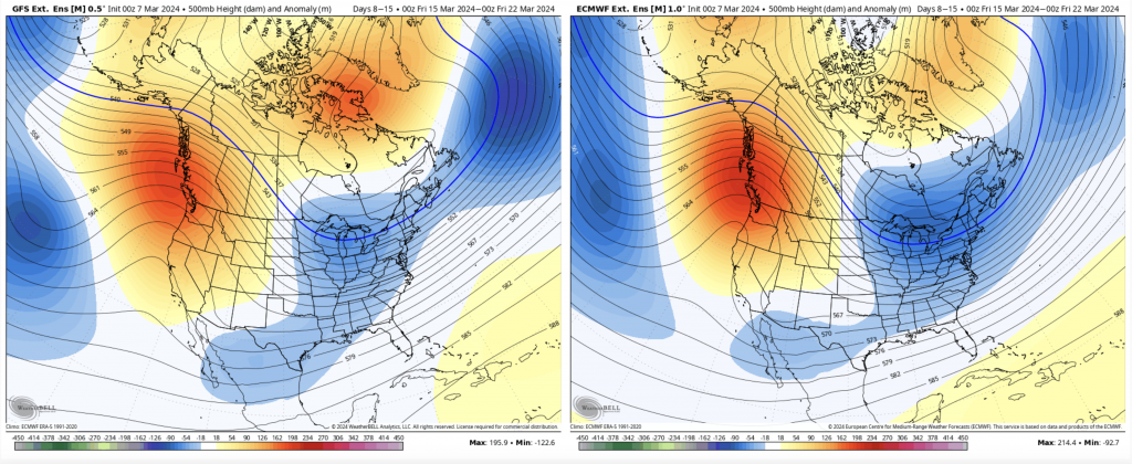
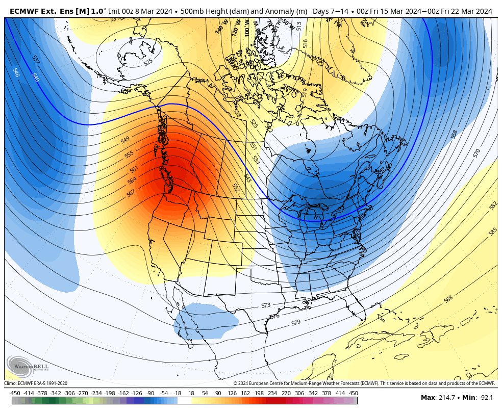
Lower heights return to the east for Days 7-14. The AO/NAO are slightly negative, but not overwhelmingly so. The EPO/WPO crash negative after the 15th, which is another signal for cold intrusions. The pattern looks to remain somewhat volatile in this global pattern transition and the PNA goes positive from the 11/12th onward. It’s certainly a promising late winter pattern, but the time of year works against us in marginal situations.
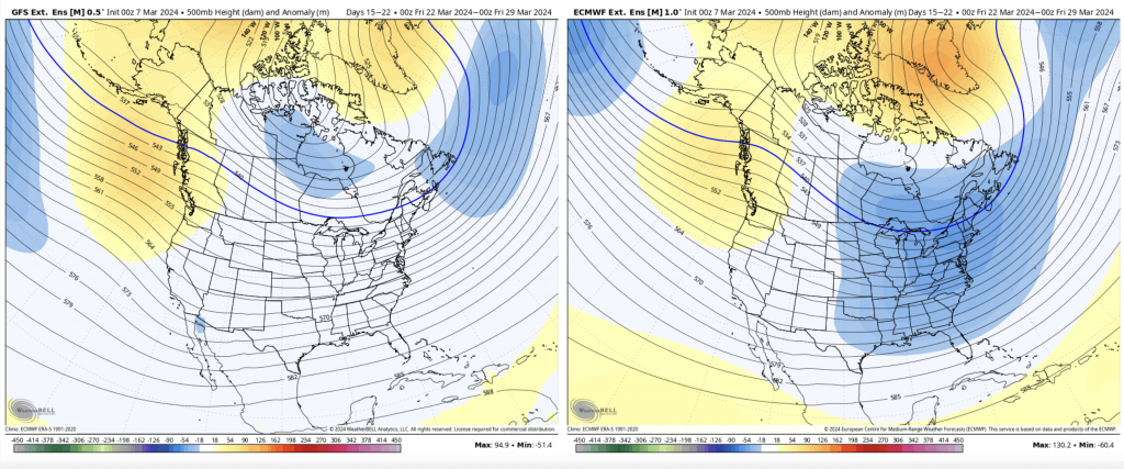
For Days 14-21, the GFS and Euro have similar overall pattern. The GFS washes out the lower height anomalies but the height lines are roughly the same. This will keep some semblance of winter in the forecast through the end of the month.