
We’re heading into a warm week next week, but the pattern should be shifting thereafter.
Before that, this cold lasted a little long than expected, with the coastal low coming up on Saturday. It’ll bring some showers, but temperatures stayed in the 20’s today and 30’s Saturday, when initially it looked like the 40’s for both days.
Heading into next week, we have a couple systems to watch in Days 7-14. There’s one 3/7-8 and another 3/10-11. There’s a lot of discrepancy in the timing but the pattern reactivates and for the most part, the warm edge of the pattern is gone.
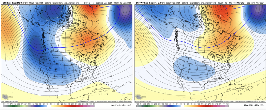
It’s easy to see the ridge lifting to the north into the Canadian Maritimes, which sets the stage for a negative AO and the possibility of cold air returning.
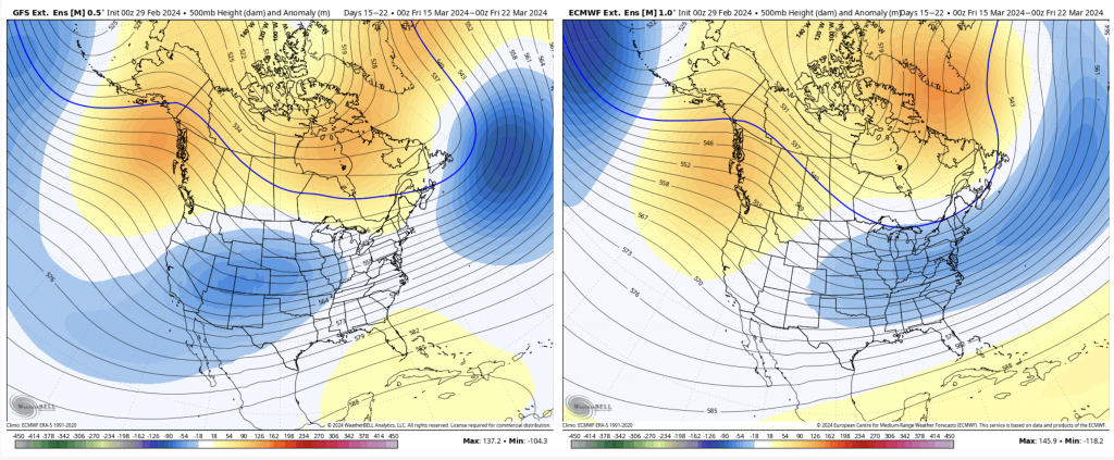
In addition, the trough moves to the central part of the country so the PNA shifts to neutral, and eventually positive as we go into Days 14-21. It’s always harder to redefine winter in late March, but we’ve seen it many times before.
While it’s a bit on the too little too late category, there’s still some March to recover in a wintry pattern, and the second half of the month looks like it’ll be in that category at the moment.
For what it’s worth (and we’ve gone down this road before without it actually happening)… the eastern trough looks to hold through mid April after it sets up later this month.
However, the long term is a bit volatile — still — (our favorite word this season) as El Niño continues to weaken in the equatorial Pacific and global patterns shift.