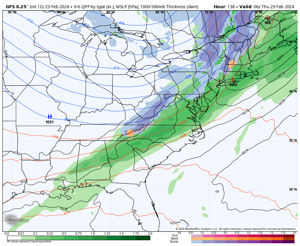
We’re about to head into a warmer phase, especially for the middle of next week. The somewhat good news is that the cold front looks to be faster — which will not only limit rain and warmth, but could also change some rain to snow before fully departing. Temperatures will crash down behind it for Thursday.
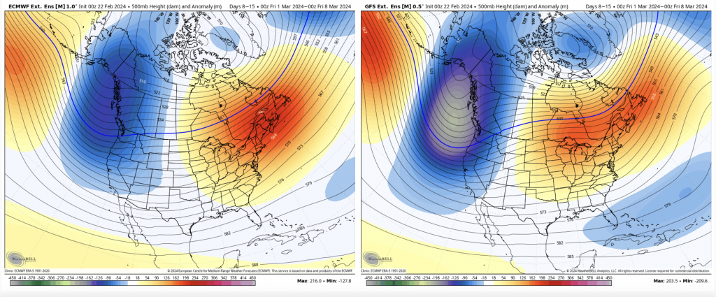
Into Days 7-14, the 500mb pattern doesn’t look great, but it is a 7-day anomaly so we’ll have some ups and down within in it.
The teleconnections say the shift will occur around 3/5 for the NAO/AO to head back negative, which means a colder overall pattern should be coming in. The pattern, however, remains volatile, which has been the key word for the pattern almost all winter.
With the weakening El Niño in the Pacific along with a negative AO/NAO, and a potentially positive PNA, we may be setting the stage for an interesting end of winter.
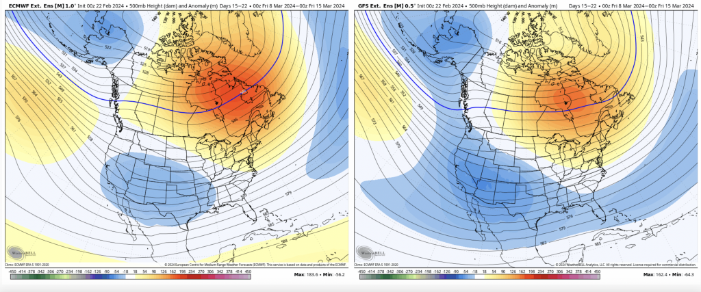
Days 14-21 show the anomalously high heights shifting north toward Greenland, which means the cold may undercut, and continue the interesting pattern.
There’s been quite the back & forth with the long range over the past several days, so I’m not going to jump too far off in it. Though the first week of March is not great news, the rest of the month looks to get progressively better, at least right now.