We’ll be back to cold with some storminess for the week ahead. The coastal storm looks to be a bit more for southern New England and the Mid-Atlantic. Following this we have a blast of cold air through next weekend.
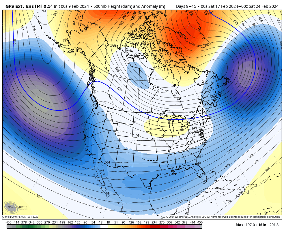
Days 7-14, our first vacation week period has an interesting look to it.
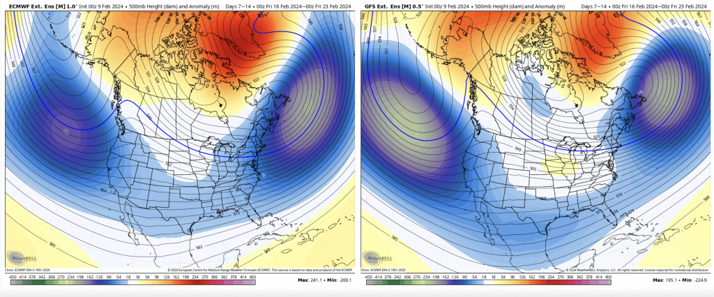
This has the look of an omega block but the pattern is not quite stationary so it’s hard to call it the block, but it’s certainly in the omega formation. At this point we’ll be seeing a negative AO/NAO and a positive WPO/EPO so there’s some conflicting signals in the availability of large scale cold.
The PNA goes neutral which signifies the trough may be setting up in the central part of the country (negative PNA would be western trough and positive is eastern trough). This could lead to inside runners but with a prominently negative AO/NAO, cold air damming would come into play.
For Days 14-21, the second round of vacation weeks, the omega looking pattern washes out and it looks to be wintry period all around.
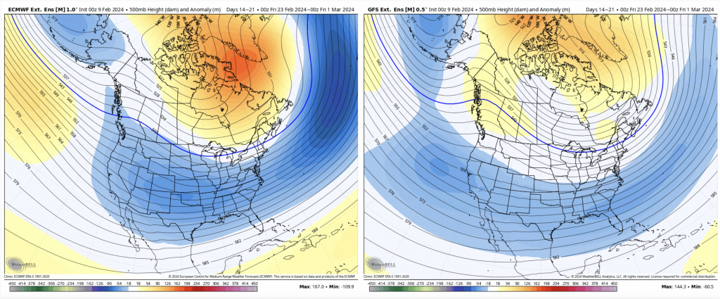
However, the teleconnections do not change much, so we may see similar storm tracks and activity but in a slightly colder fashion.
We are still in a strong El Niño period, therefore coastals with multiple precipitation types are possible until we start to see this weaken.