We’re going to continue seeing very minor bouts of “warmth”, and by warmth…it’s really more like “not as cold.” Mixed precipitation events may be more prevalent in Days 7-14 as we transition.
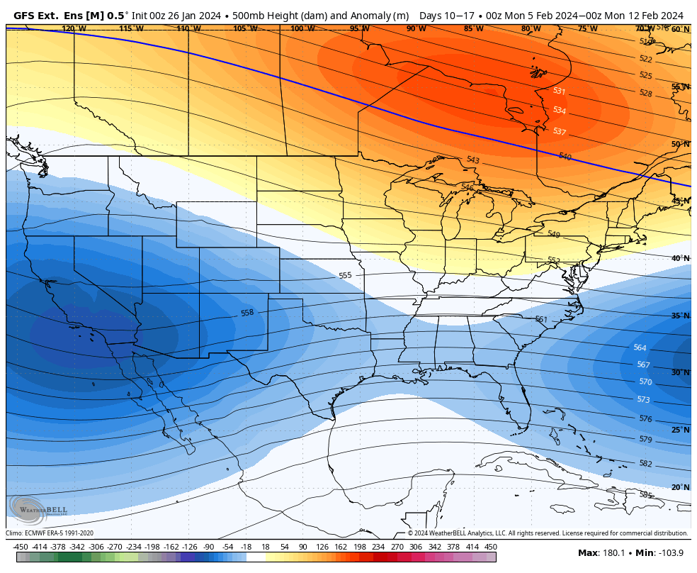
For the week of Feb 5, we’ll see a warmer cored air mass centered just north of the Great Lakes, which will bring some warmer air to that region. What this provides the Northeast is a storm track that may favor some coastal systems, but there’s little to hold in cold air initially.
The EPO begins to go negative around Feb 4/5, and the AO/NAO move into negative territory around the same time. Therefore we should see some movement towards a colder air mass at the end of this period.
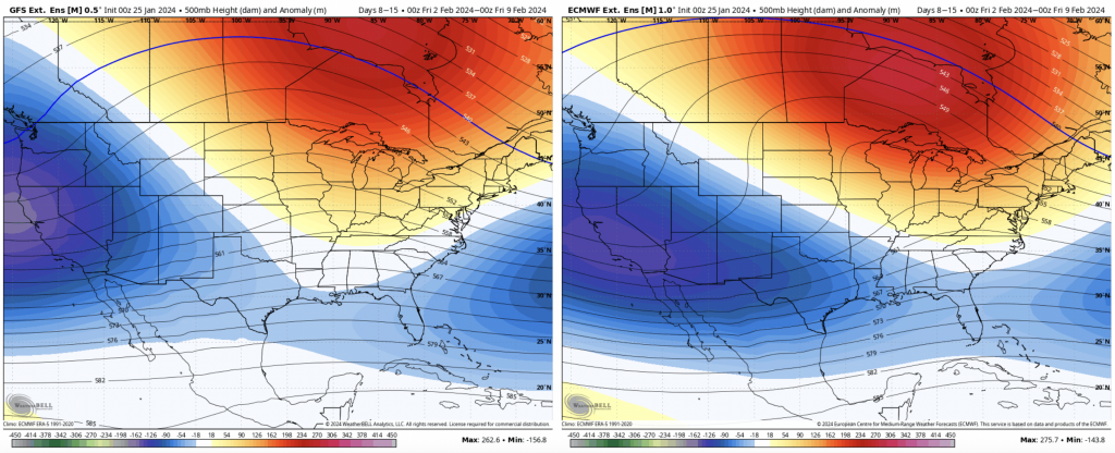
For Days 14-21, the colder and stormy pattern is back in place, for the Great Lakes as well. The PNA remains positive, though it’s close to neutral Feb 2-10, before gaining more positivity from there.
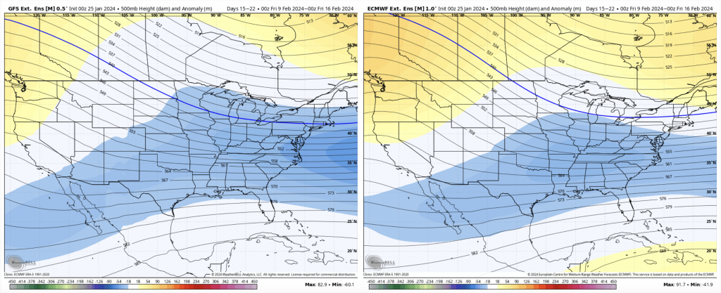
Therefore the active pattern may subside slightly in that time, but is expected to surge back toward the second weekend of February, and should be fruitful toward the vacation weeks.