This is our week of moderation, though there’s no blowtorch of temperatures occurring, it’s actually more like a rollercoaster ride of somewhat seasonable temperatures and inclement weather.
A weak wave of overrunning precipitation comes through later Tuesday into Wednesday morning from the Great Lakes to the Northeast. This is a warm front passing through but cold air damming tries to keep the cold in place, therefore outside of the Mid-Atlantic/Catskills, we barely reach the upper 30’s in most locations at the height of this warmup.
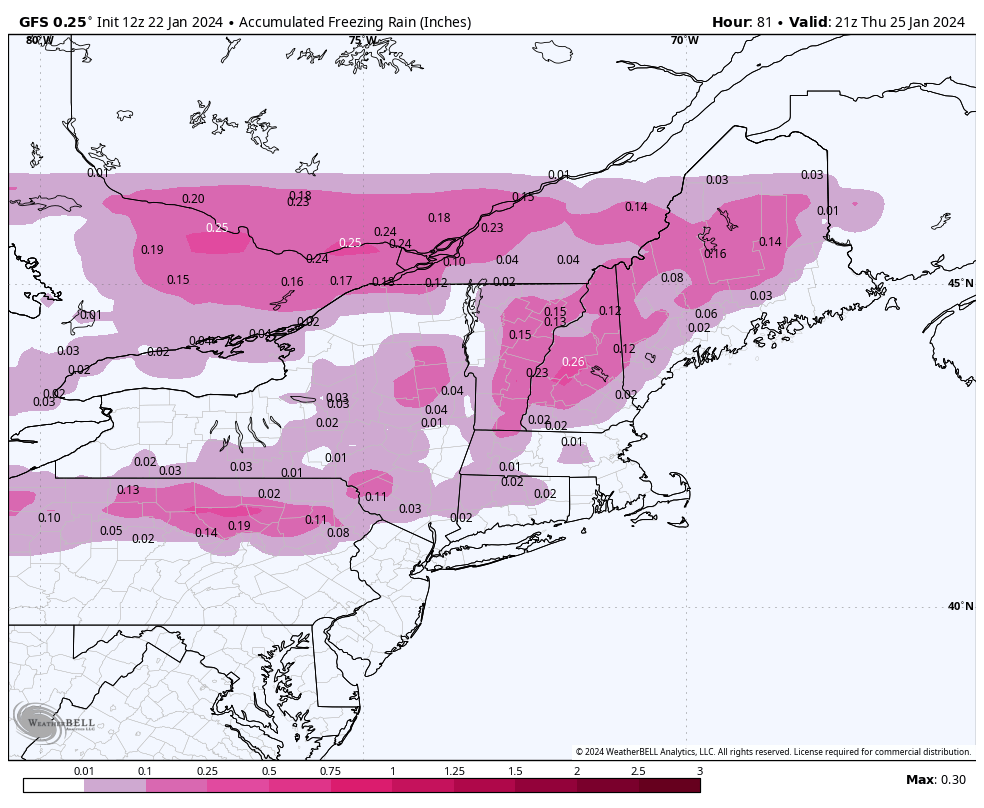
The light snow, which accumulates roughly 1-2″ across the board… turns to light ice by Thursday morning, eventually changing to rain in all areas except the cooler valleys of VT, NH, and ME where the damming holds on strong.
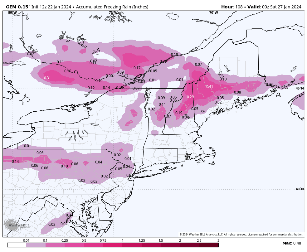
Ice accretion is a concern for operations Thursday and possibly Friday before the damming breaks (image of total accretion through Friday night) and we see plain rain — though temperatures are still only a touch above freezing as the rain falls.
This system moves out on Friday, and a quick shot of cold moves back into the Great Lakes, but may be subdued momentarily in the East as the models are picking up on a potential coastal system for Sunday. While not great timing, this would at least finish off a week of “meh” weather with some possible accumulating snow.
We’ll likely have a couple weeks of this up/down pattern — mid month February looks to be the turning point back to snow and more sustained cold.