Our arctic cold spell comes to an end heading into Monday with a brief “warm up” during the week. There’s not a ton of warm air in this, but it’ll get near/a bit above freezing at the height of the day, with a couple systems coming through as well – expect all p-types with these.
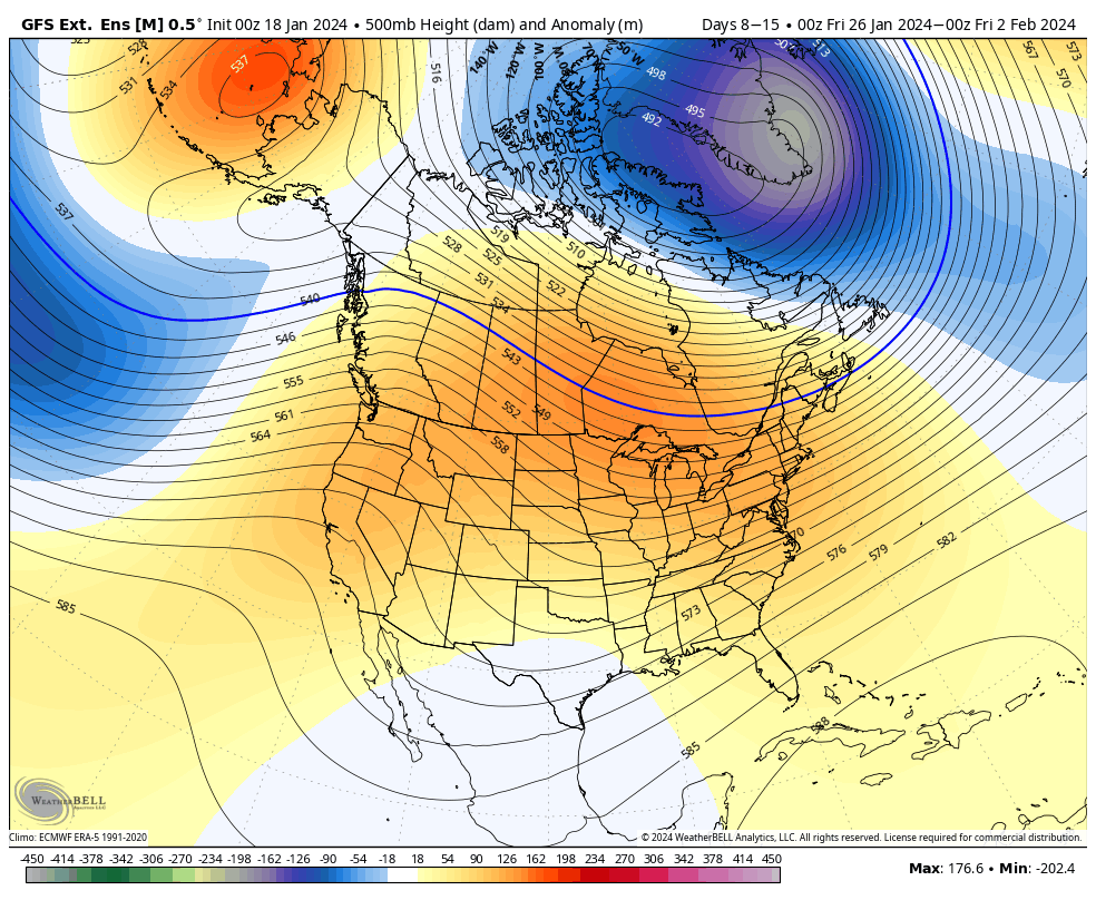
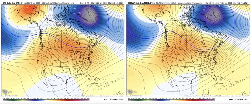
Days 7-14, we start to ease up on this “warmth”, but we’re not getting back into the arctic cold heading into the week of Jan 29th.
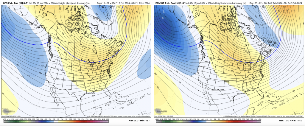
There’s not much change for Days 14-21, as there’s some slight moderation expected again during the week of Feb 5. However, this will be similar to the moderation this coming week — not warm, but warmer.
Some things to note…
The AO/NAO now does not look to go negative until Feb 7-10, depending on the model. However, they’re both falling from Jan 24/25 onward…therefore that’s not a doomsday signal. This means cold may struggle to hold, or be more shallow heading into these next 2-3 weeks. We also have a positive PNA the entire time, which means the pattern remains active. Icing could become more prevalent as cold air damming becomes the larger forcing for cold, rather than the overall air mass.
Mid February onward looks to settle back into cold and snow.