A quick blog for the week ahead…we’re not seeing much change in the forecast as it’ll be a cold week with some minor bouts of snow.
The 1/16 storm system revived itself in the last couple of days, once again giving credibility to the Canadian model who never gave up on this storm system when the GFS/Euro had written it off up until last night. This will bring a light snowfall of 2-4″ to most areas with the exception of Maine, which may see 4-8″.
The lake effect snow machine begins to taper heading into the midweek for the Great Lakes region and off the NY lakes.
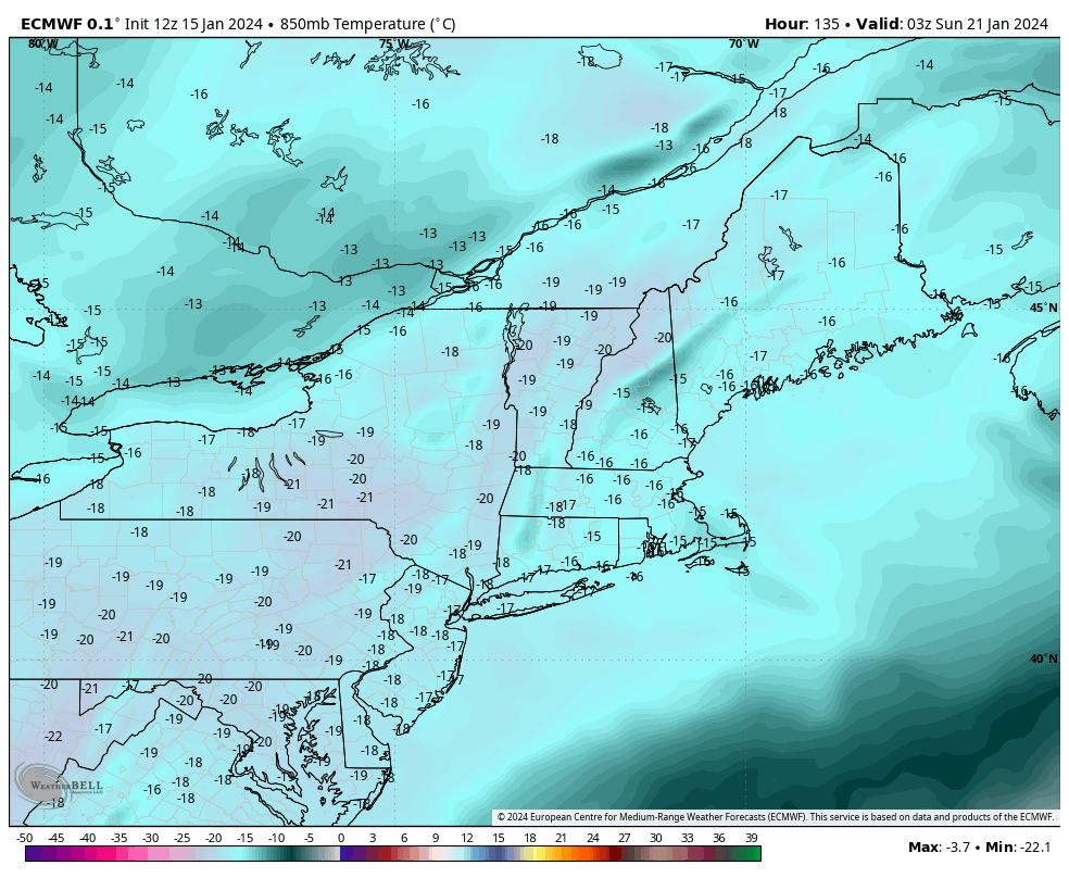
There are several blasts of arctic air coming in during the week, but the coldest settles into the Northeast Saturday into Saturday night (image to the right) behind the final system in the pipeline, with Wednesday night not far behind.
The 1/20 system favors more of a southern New England/Tri-State storm…which leaves New England prime for cold.
Everyone begins moderating Monday, 1/22 with a brief break in the cold and snowy pattern.