We’re about to see our third system in 6 days arrive in the Northeast, and we’re not done yet. This one will be similar to the Tuesday/Wednesday storm, but honestly the latest runs look a smidge more intense with the damming. So while we’ll probably still see a transition to rain in all areas, snow may hang on a touch longer.
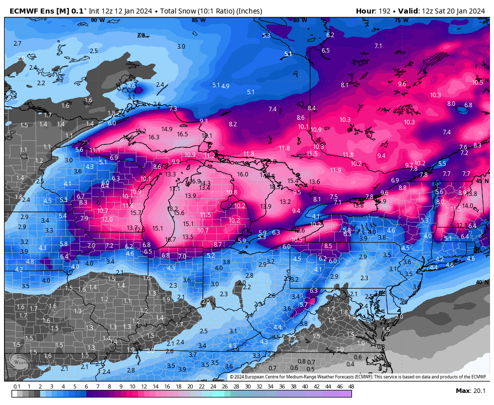
Meanwhile, light snow begins in the Great Lakes and doesn’t stop for over a week, thanks to the lake effect snow machine going hog-wild with the arctic fronts. This is the Euro Ensemble on a 10:1 ratio for the snowfall through 1/20. Ratios will surpass 10:1, so you can add about 50% to those totals in MI and off the NY Lakes.
The next system for 1/16 is still inconsistent with phasing. The Euro was excited about a large coastal storm a couple days ago, then fell off the wagon with that idea yesterday. The GFS came on board with the idea 2 days ago, and today has fallen by the wayside. The Canadian is still bullish with it, but remember, the models won’t nail one storm before another has come to fruition….so we wait.
Next week’s headlines are more likely to be about the intrusion of the polar vortex rather than storms, unless the 1/16 decides to go all Blizzard of ’96 on us (which the Euro showed earlier this week). Cold air will be entrenched in the east through next weekend.
With all extremes…come some sort of ping-ponging the other way. We’ve had nearly 3 weeks of overall colder temperatures and an active pattern. Therefore in order to maintain some sort of equilibrium in the atmosphere, which is the whole cause of weather in the first place, we have to nudge the other way for a bit.
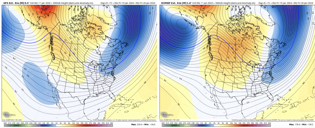
The good news is, I don’t think it’s for very long. For Days 7-14, we’re transitioning out of the current cold and stormy pattern, for about 5 days. This is the 7 day 500 mb height anomaly, so we’ll be in the thick of it for a couple days to start off this 7 day period. I don’t see a blowtorch in this time, but we’ll likely lose consistent snowmaking nights and perhaps have a warm precipitation event. This is not uncommon after polar vortex intrusions. Give a day or two to transition in and out, we’re looking at 7-9 days max of being out of the pattern we’re currently in.
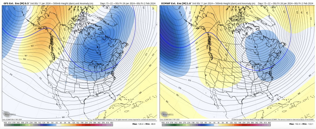
I say it’s short-lived, because by Day 14-21, we’re already back in the thick of it — not just transitioning, but we’re there. This is likely a pattern reload or regeneration.
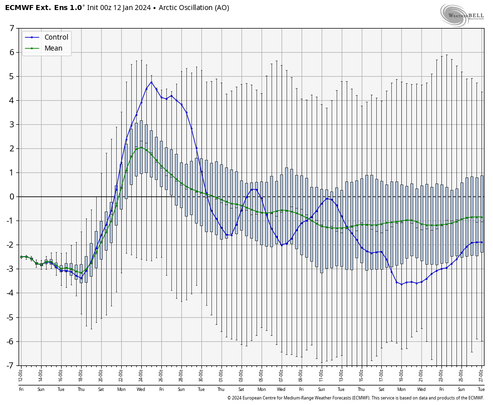
There is consensus through all models on the AO heading right back into negative territory after a peak around January 23rd.
The MEI is showing a moderate El Niño from November/December, while the ONI is still a strong one…therefore with this more conclusive agreement between the two, we’ll see a very El Niño like pattern take shape for the remainder of winter.
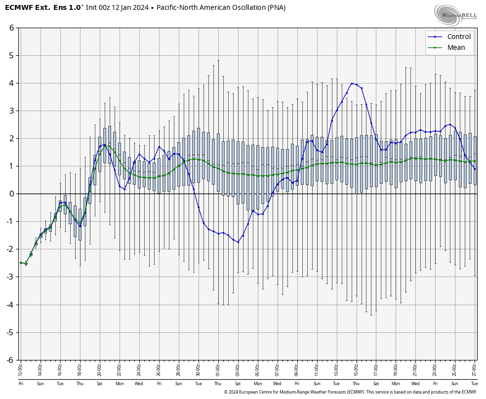
Case in point, a positive PNA through the end of February. Along with a negative AO, NAO, EPO and WPO…this has some serious potential.
All that to say, January (so far) is likely just a taste of the fun to come. I wouldn’t get too hung up on the “thaw” for Jan 21-27-ish, it’s all part of what should be happening in a season like this.