The long term continues to look fairly volatile through the first 16-18 days of the month.
We have the storm system tonight/tomorrow coming in, and another for Tuesday/Wednesday. While this will bring predominantly snow in the Great Lakes, it’ll be more of a mixed bag for the Northeast. Maine will hold onto snow the longest, but everyone will change to rain at some point.
There’s one more system the models have been fairly consistent on picking up, that comes 1/13-1/14, another coastal low that will move up the east coast. That is not surprising with this pattern.
For Days 7-14, we’re going to start to ease off the gas pedal of this colder and volatile pattern. It can’t stay forever — you need a recharge, and it will likely in week 3 of the month – Jan 18-25..ish. I don’t see a huge thaw, or anything that looks like a blow torch.
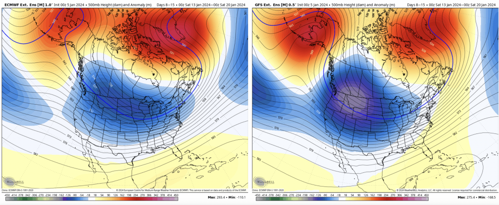
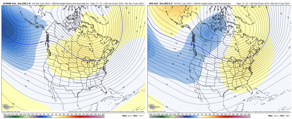
Here’s Days 14-21 before I get into more of why I feel that way.
There’s decent agreement among the GFS/Euro regarding the placement of a mild ridge over the east. This is fairly normal after a cold pattern, which we technically got into on Dec 29/30. Therefore by this point, it will have been 3 weeks. The Euro is a bit more broad brushed with the ridge, which isn’t a very warm solution (and that’s against the usual bias of the Euro as it doesn’t like to see cold).
This also aligns with the teleconnections — which are consistent for each model, though the output of the Euro 500mb makes a bit more sense given the teleconnections.
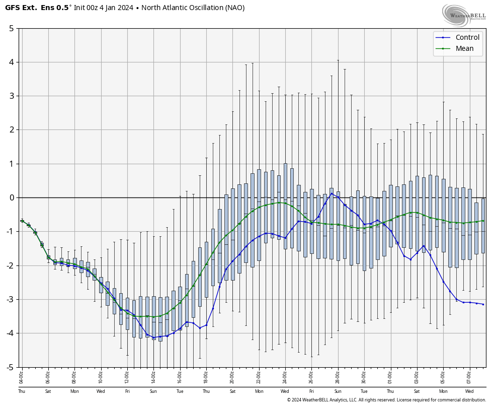
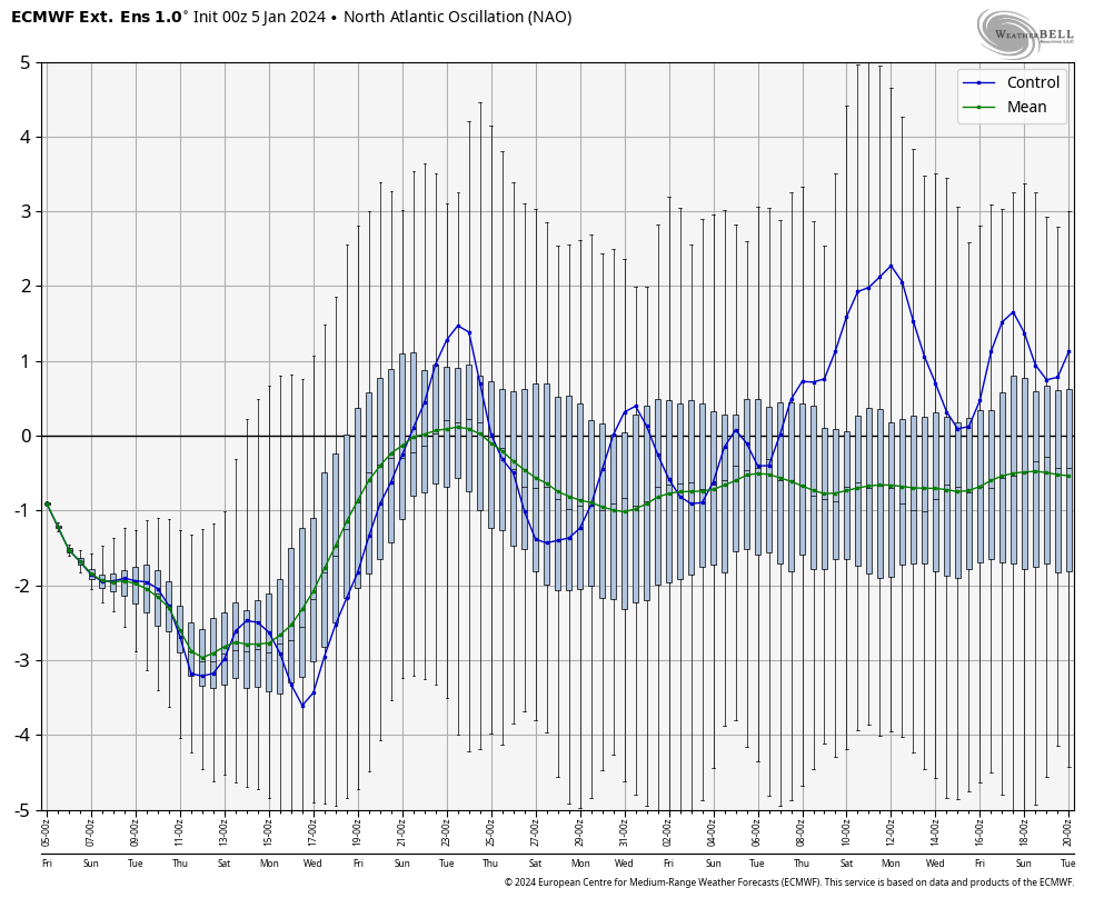
These are the forecast NAO’s through the first we of February (the tanking NAO in both the GFS and Euro beginning on the 8th only gives more support for a colder run of the 1/10 system). It hits rock bottom around the 11th, and begins moving up around the 16th (arctic intrusion in that time frame). This peaks around the 24/25th, but notice it never really goes positive, it just hugs neutral. So this doesn’t mean we’re doomed for rain/warmth, it’s just less amplified than where we are now.
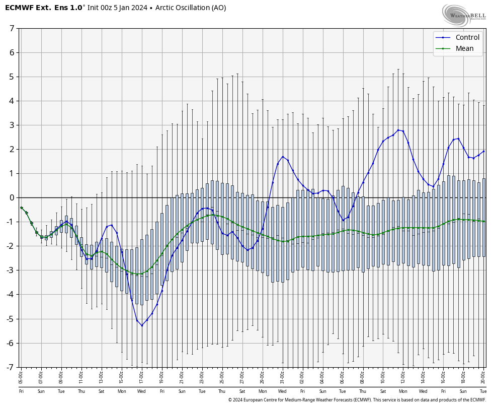
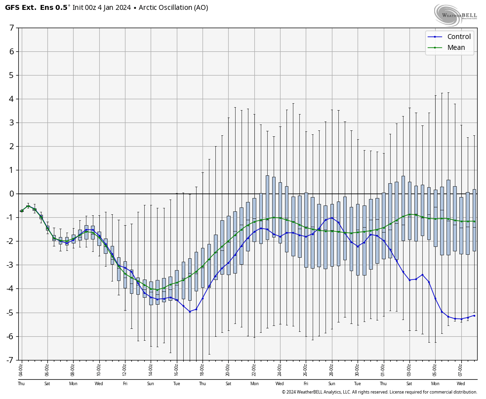
For more support of that point, I bring up the AO — the AO showcases the availability of arctic air, where the NAO identifies if we have the blocking to hold it. The AO tanks in the same way that the NAO does, but doesn’t even get to the zero line, which says we’re not seeing anything tremendously warm, just less cold, before it starts heading back to more negative territory.