The cold is transitioning into the region through the last couple days of the year. We’ll have a couple bouts of cold come through next week, including a potential coastal system on the 5th.
From there, we have an overwhelming negative anomaly throughout much of the country for Days 7-14. There are storm signals on the 7th, 11th, and 13th. Overall the pattern looks active.
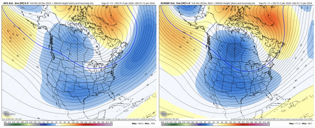
Beyond, this time, we have a negative PNA, which means that we’re not expecting a stormy pattern in the east. This is likely due to the intensity of the cold and the jet being pushed to the south. We also have a negative AO and NAO.
In the latter part of Days 14-21, we start to see this intense cold pattern ease up. Usually in pattern shifts, we start to see an active pattern re-engage.
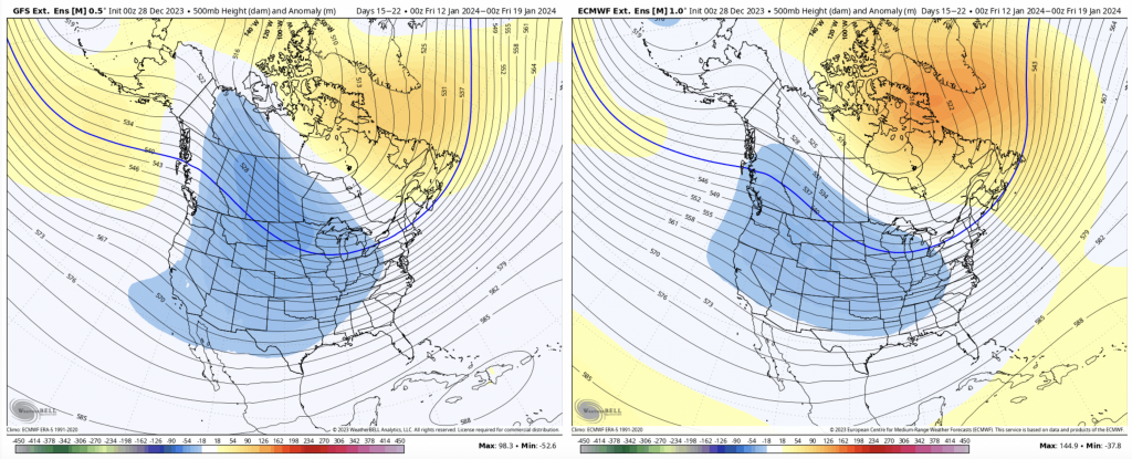
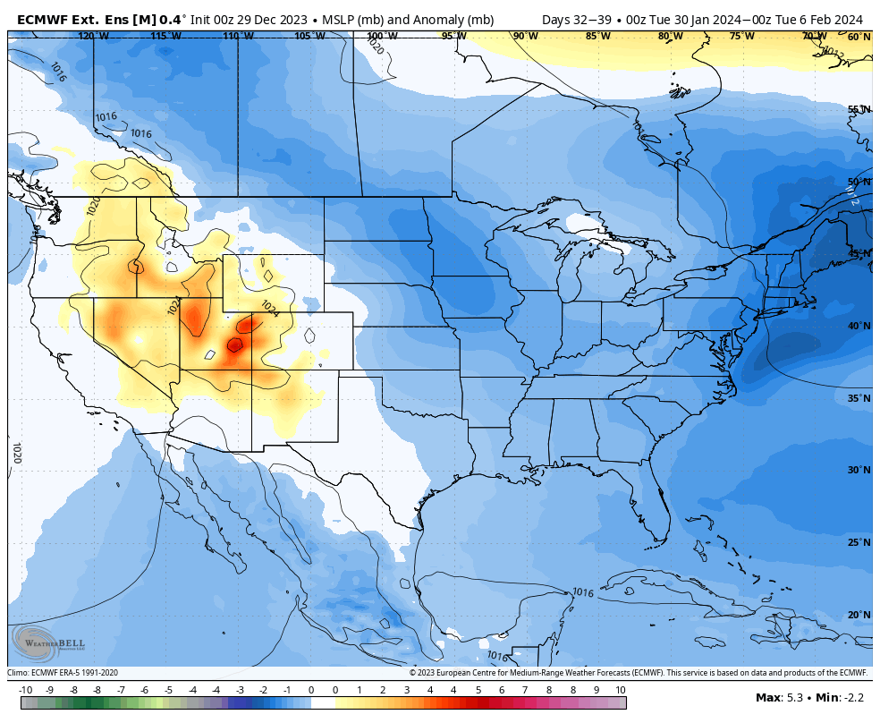
The negative anomaly is sitting more in the central part of the country, but the long range has had a westerly bias this year, so I would not be surprised to see this adjust in the coming days/week.
Beyond Day 21, there’s a lot of discrepancies — the 500mb anomaly doesn’t match up with the teleconnections. There will probably be a continued ease of the pattern before the cold comes back, but the details in this are too disconnected at this point.