It’s a fairly dreary week in most areas as the pattern continues in a transition. We’re kind of in a no-man’s-land of little flow and wind to move things around.
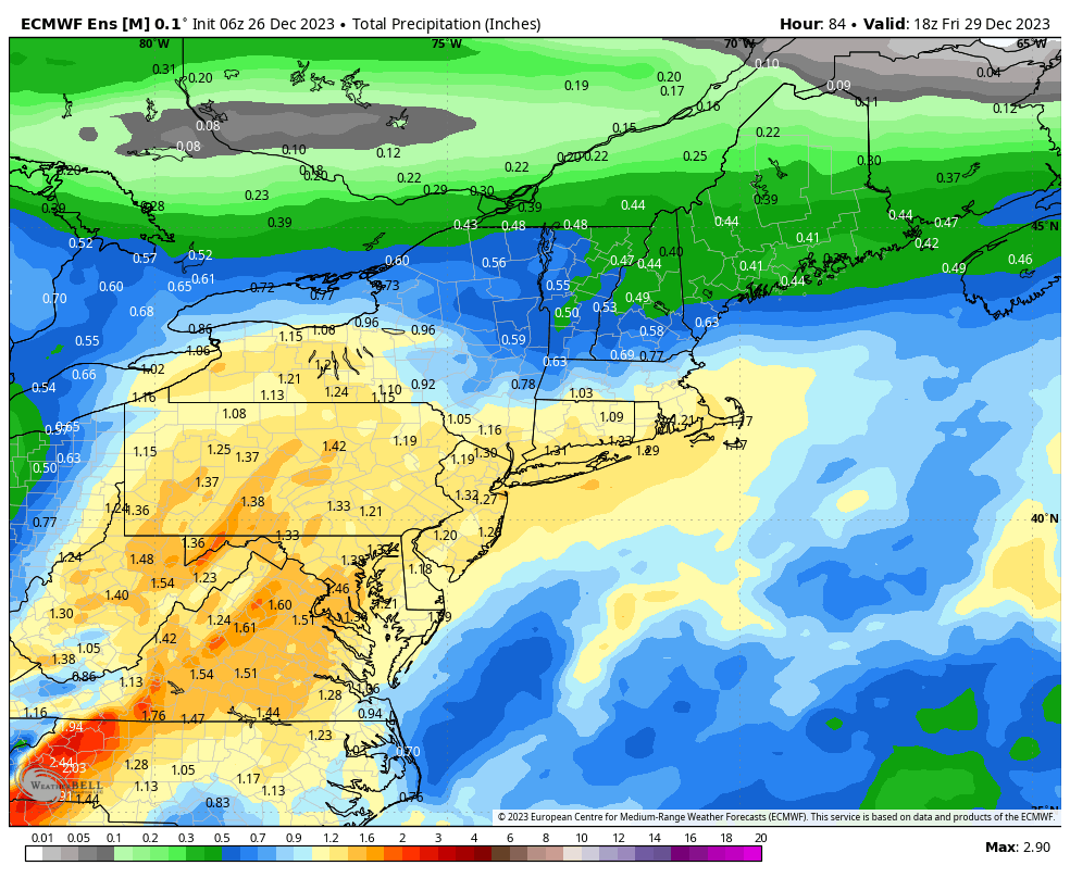
We have a low pressure developing for late Tuesday into Wednesday with rain expected. This won’t be the torrential rain of our last few storms, but rain nonetheless (image of euro ensemble totals through Friday afternoon)
We’ll start to see the cold transition in from the north, and this begins to occur Thursday evening.
It will come in at the lower levels first, therefore we will transition from rain to freezing rain before seeing any changeover to snow. The low begins to stall on Friday, and the stalled low prevents the strong cold from coming in. The snow changeover likely comes Friday night, but it will be very light and at this point, not amount to much through the day Saturday.
Stronger cold begins to push in on December 29th in the Northeast, but it won’t get truly deep until the first couple days of January for both the Great Lakes/Northeast.