The transition is starting…roughly 7-10 days later than anticipated, but nonetheless it begins with the system coming through on Monday. That system will be mostly rain and quite a bit of wind as well.
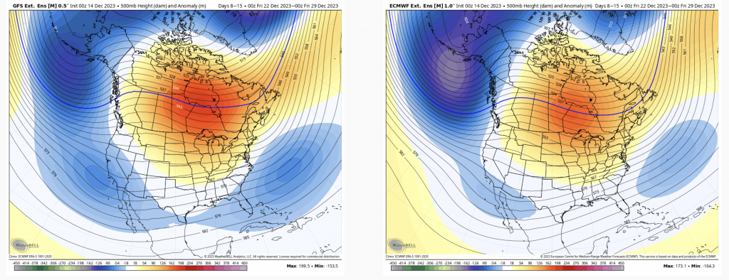
For Days 7-14, we are in the thick of it in the NE. While the bright red spot in the middle of Canada looks menacing, these are 500mb height anomalies. That means have high pressure in that red center; and with clockwise flow around high pressure, it’s delivering cold air into the east, while the Great Lakes and Midwest likely stay under warmer conditions for another couple of weeks before see the cold shift back toward the center of the country. The GFS is a little stronger with the negative in the Atlantic, but I prefer that solution, as we should have more equal magnitudes of anomalies. This setup signifies an active pattern while seeing more frequent and consistent cold intrusions in the east — focused more so after Christmas.
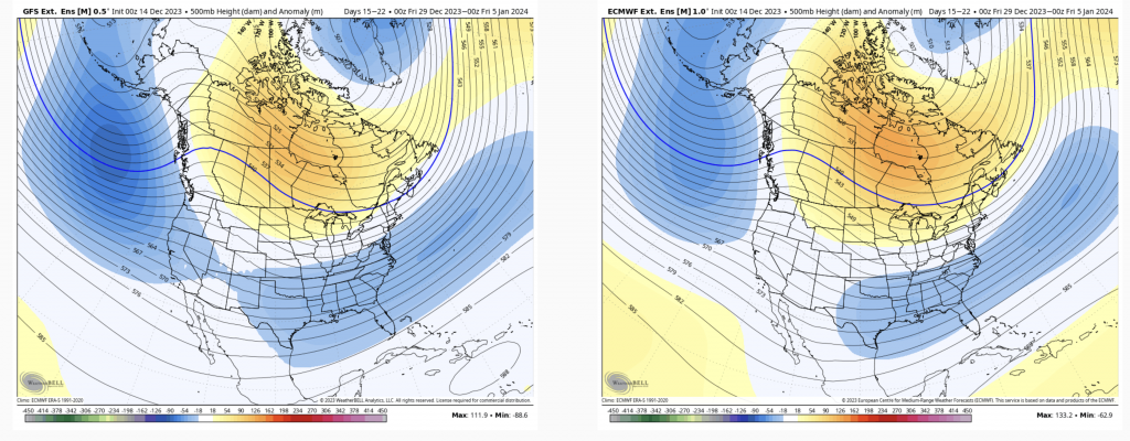
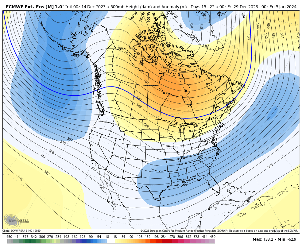
By the time we get to Days 14-21, it’s clear to see the eastern trough developing and taking hold. The high pressure center has lifted north to the poles, signifying a negative AO (Arctic Oscillation) and NAO (North Atlantic Oscillation) — which is a correlation to cold moving in. Strongly negative AO’s and NAO’s provide cold, but usually shunt the jet stream/storm track to the south. This should bring some consistent snowmaking opportunities while preserving any snow that had fallen the previous week.
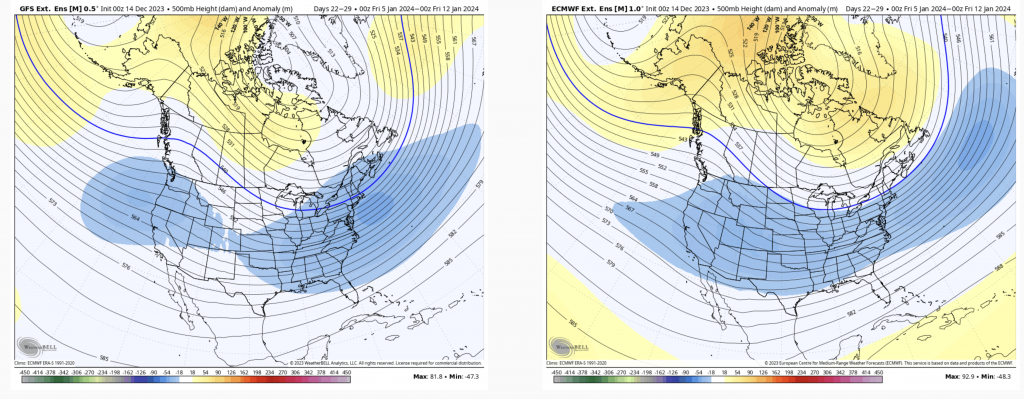
And to go one step further, here are Days 21-28. This is cold pattern for the majority of the country, bringing an end to warmer temperatures to the Midwest/Great Lakes, and could bring snow to areas not used to seeing snow and/or cold temperatures.