The week ahead is fairly quiet in terms of precipitation, but we are going to see a lot of movements in the temperatures in terms of weak fronts/shortwaves coming through. This may lead to non-diurnal temperature movements, which I’ve tried to outline in the discussions as well.
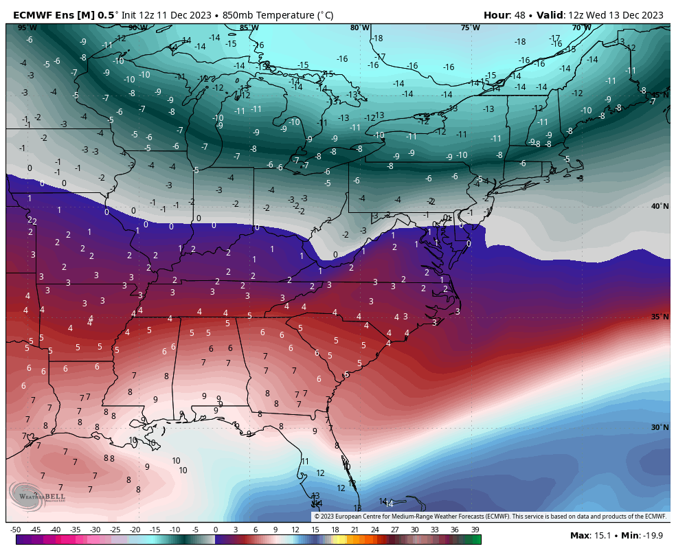
Temperatures are already moving up in the Great Lakes overnight tonight for a warmer day Tuesday. A cold front tracks through the Great Lakes Tuesday, dropping temperatures for Tuesday night…as its en route to the Northeast for early Wednesday morning. Therefore as we see peak warming in the daylight hours Tuesday, we’ll actually continue it or steady temperatures for a large chunk of Tuesday night before seeing them come down early Wednesday morning, and steady or continue falling Wednesday. Wednesday night is the coldest night of the week for the Northeast (image of 7am Wednesday morning as cold settles).
Thursday remains rather cold in the Northeast but already seeing moderation to the west as another front approaches. Friday and Saturday will be warmer days all around, with dropping temperatures slightly into Saturday evening as a weak cold front sags over the north. This is short-lived, as we warm back up on Sunday when that front lifts north ahead of an incoming storm system.
We’re keeping on trend with another system possible for late Sunday/Monday of next week. It’s still too early to see details, as runs shift from a behemoth rain event to a cold front pushing the low pressure offshore. Either way, cold air reinforces behind it for our entrance into the holiday weeks — this should be the beginning of our transition point into more consistent cold.