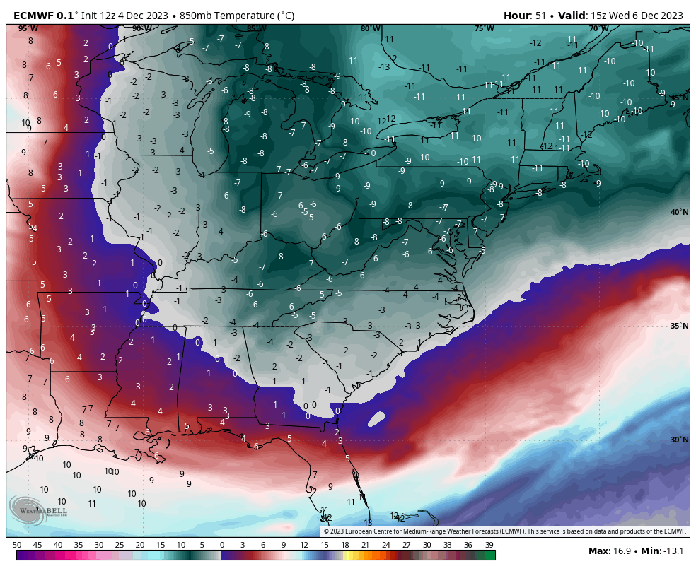
Our early week snow was the main event for the week, which brought quite a bit of accumulation to New England, especially northern regions. We have some downtime with cold air and snow showers coming through into Tuesday. The cold reaches its core Tuesday night in the Great Lakes and Wednesday in the Northeast.
The cold begins to depart from west to east beginning early Thursday through the remainder of the week. We’ll rebound into the 40’s and 50’s before a strong low pressure system arrives Saturday night in the Great Lakes and Sunday in the east. This is likely to be a warm and windy system, with some cold air behind it.
In the long term blog, we pegged 12/7-12/17 as a volatile time frame with some bouts of cold but greater variations of warm. It’s likely that the 12/10-12/11 storm is not the last non-frozen storm before we transition into a cooler pattern closer to Christmas.