
We’re about to enter into a very interesting short term and long term pattern.
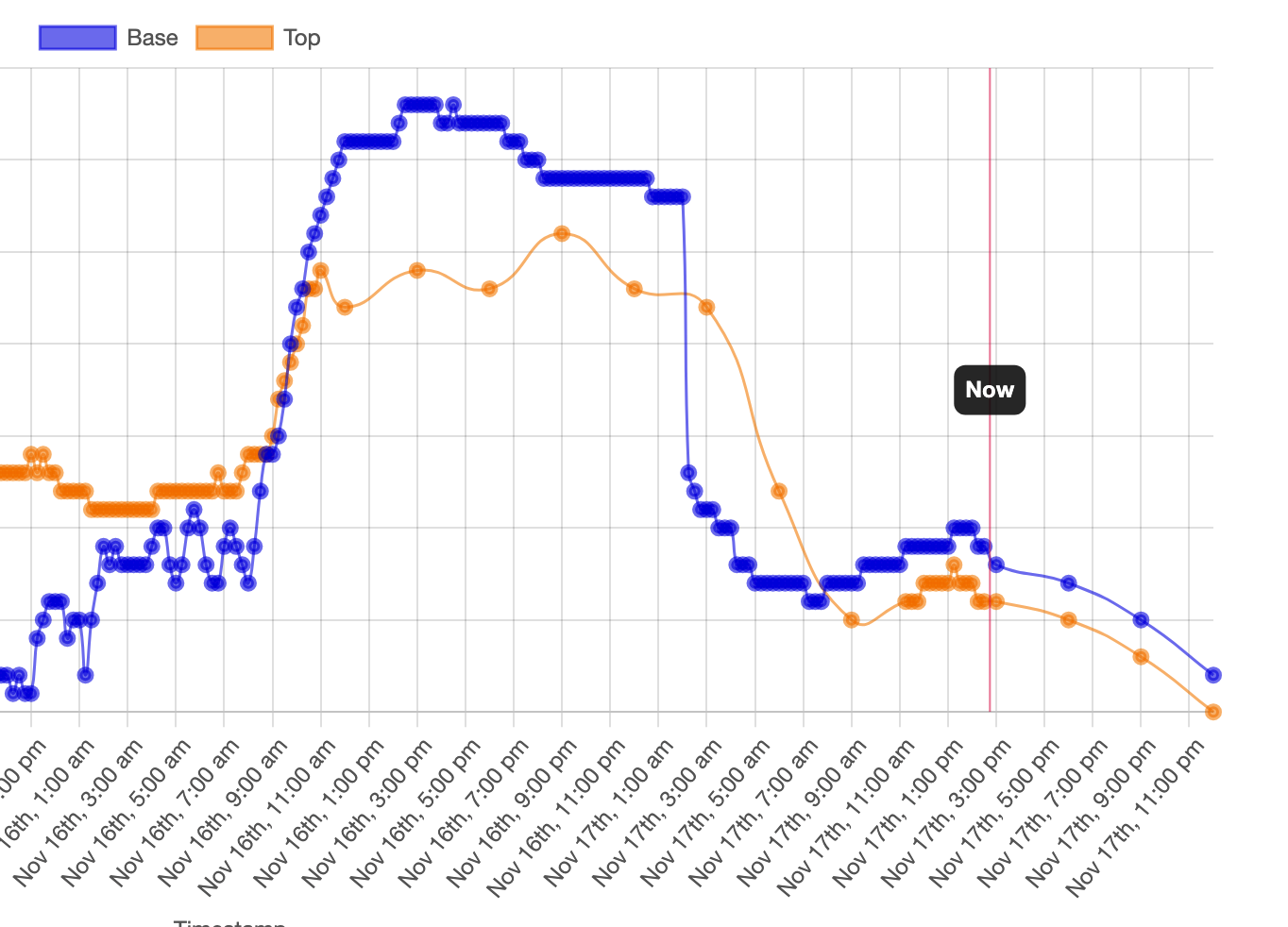
A strong cold front is en route to the east (take a look at the blue line in the screenshot of the front coming through a resort in Michigan). I don’t have the drop quite as sharp in the Northeast (12 degrees in 15 minutes) but it is going to be a fast moving drop heading into Saturday morning.
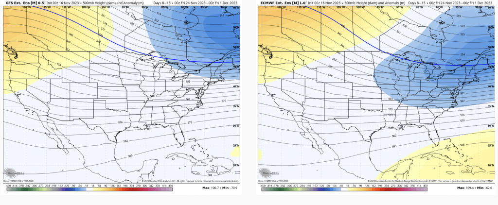
Next week we’re watching a storm system on Wednesday, which now has some conflicting signals in terms of if the energy is really coming with this particular system — there’s another on its heels for next weekend. While we’ve certainly seen back to back strong systems, typically one will be stronger than another, take a different path, or have different energy streams. It’ll be interesting to see how this materializes over the weekend.
For Days 7-14, we’re seeing the trough shift east, but this could set up the stage for a continued active pattern while still maintaining some semblance of cold. This will probably be a bit of a volatile time period.
Moving beyond this time frame, we’re seeing the pattern become a bit more zonal – not seeing those troughs and ridges so well defined – but we’ll likely see a period of some moderation in temperatures with less volatility.
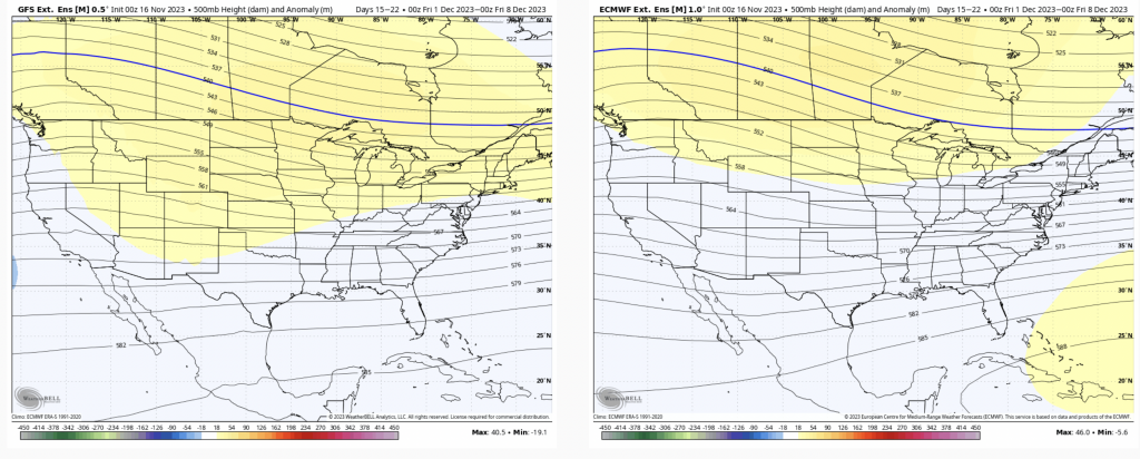
We’re still in a period where I don’t believe the models are really understanding the long term very well, but since we’re in such a critical time frame, I wanted to post some initial thoughts. With a couple strong cold pushes over several weeks, it makes sense to have a break. Very long range signals (for what they’re worth) show the cold returning the week before Christmas.