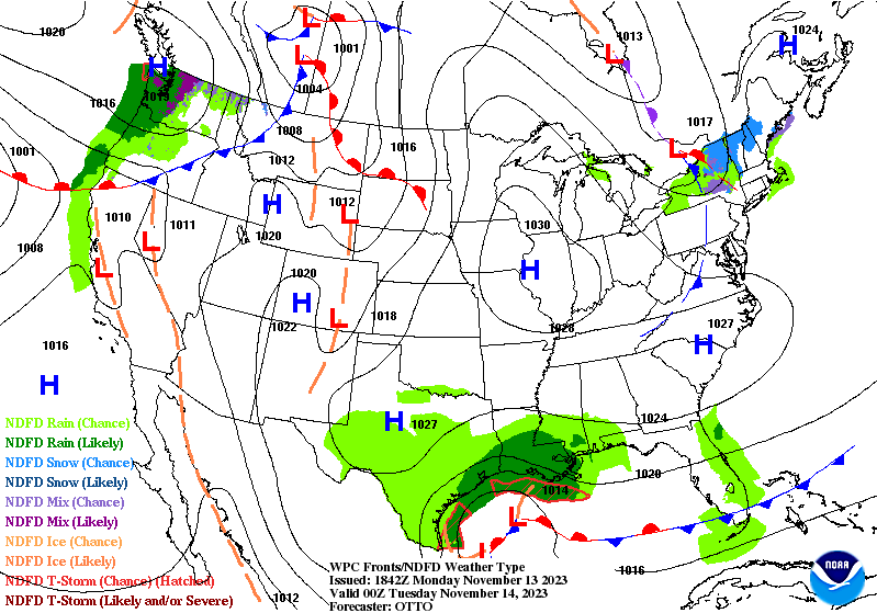
Inversions stuck around for quite some time today ahead of a weak system coming through New England tonight. We’re seeing it dissipate as it moves through the area, so we’ll likely see some minor temperature movements (up and down) as the warm front and cold front move over the Northeast while simultaneously breaking down (WPC image to the left).
Since the cold front breaks down as it’s moving over the area, we’ll only see minor cooling in the wake of its departure. Another area of high pressure moves from the central part of the country to the east — beginning a warm up in the Great Lakes. The cold retreats for Wednesday in New England.
We remain under the influence of high pressure heading into Wednesday before another weak front moves in Thursday. This drops temperatures momentarily ahead of the strong cold front coming in for the weekend.
Thursday is the warmest day in the Great Lakes before the front approaches with strong wind and some light rain, with temperatures falling through the day Friday.
This quickly moves east, with Friday as the warmest day of the week before the front comes through Friday night. Rain is expected to be the dominant precipitation type with some snow possible toward the end as the cold air rushes in. While the tropical disturbance comes up the coast, at this point it does not look to phase with the front until its offshore. Will continue to monitor that timing as any shift in speed of the front or the low could change that outcome.
We’ll see temperatures fall through the day Saturday and steady off into Sunday before another surge of cold brings another shot of cold air in for Monday of Thanksgiving week – potentially the strongest cold punch of the seasons so far. This could be the first time areas in the Great Lakes and Mid-Atlantic can fire up the guns…will continue to watch the depth of this cold blast.
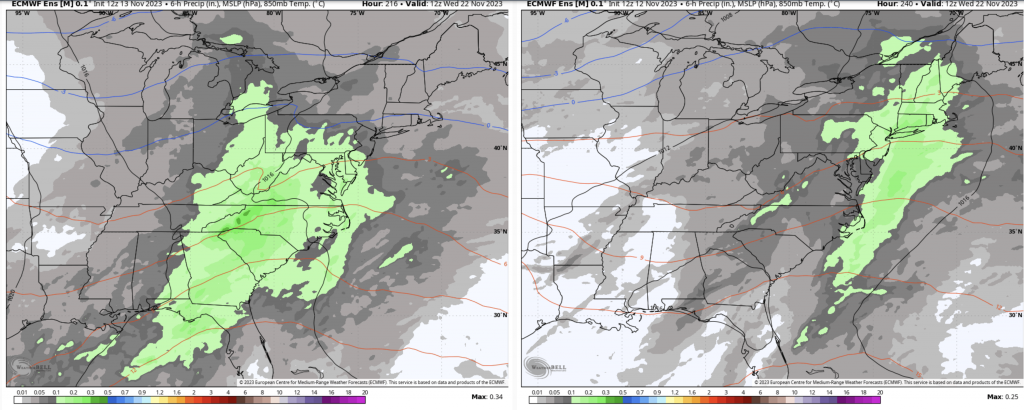
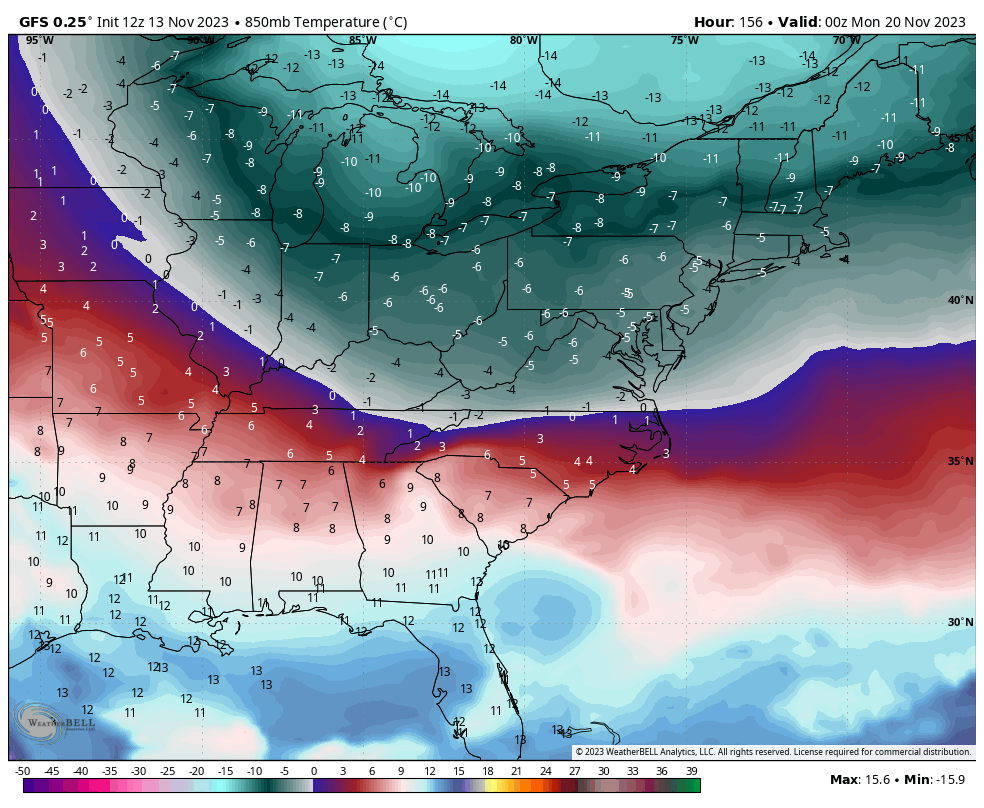
I chose to post the 850mb temperatures from the GFS because it has been handling the long term in the Day 7-14 range significantly better than the Euro. As mentioned in the long range blog, I believe the discrepancy between the high SST’s in the equatorial Pacific (indicating strong El Nino) and the MEI, SOI and other indexes showing more ENSO neutral or weak El Nino — is causing major disruption not only in the models but in the atmosphere itself — though the GFS is picking up on the changes, and especially the cold, much quicker than the Euro. Only in the last day…it’s clear to see the Euro adjust in the long range. Below is today’s 12z Ensemble on the left, yesterday’s on the right, valid for the day before Thanksgiving. The 0C 850mb line shifted from Quebec City/northern Maine to the Hudson Valley/Cape Cod…