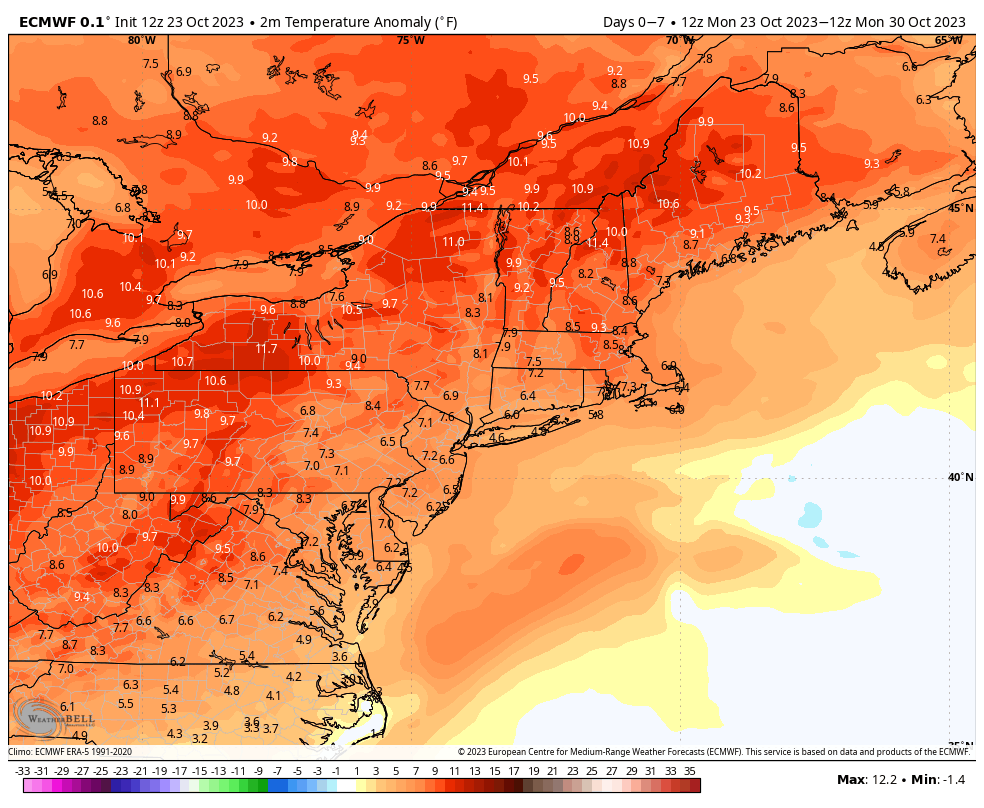
After another rainy weekend, we’re heading into a warm pattern for the end of the week. I hesitate to call it the last hurrah of warmth, because I think November will be a transition month, but it could be last prolonged stretch of it.
Temperatures will be some 8-12 degrees above average through the weekend and into early next week.
We won’t see much in terms of precipitation until the end of the weekend, and even then, the bulk of any rain (or snow – still too early for p-type details) would likely come on/near Halloween.
That brings us to the first cold blast of air to come in for the season. It doesn’t stay long, but looks to be deep enough that even areas into the Mid-Atlantic could at least fire up the guns for a test, and northern New England could have summit level temps < 28F for nearly 36 hours. Details still to come, but the key on prolonged cold is waiting for the tropics to die out, which we are still waiting for. It will be interesting to see if Tammy becomes involved in the frontal system next week.
A touch into the long term; we do moderate again after this cold blast – not to the levels we’re seeing this week, but back to the 40’s/50’s. As mentioned, I believe November will be a transition month, so we’ll see the cold come and go before settling in more consistently toward the end of the month.