We’re in a typical fall pattern heading into mid-month, with some lingering showers to start the week, and heavier rain possible over the weekend – again.
While the thought of another rainy weekend isn’t exciting, it’s encouraging to see a cycle forming in the weather pattern. This is something we haven’t seen since the spring. In addition, the number of coastal lows forming/trying to form shows that El Niño is starting to show itself in the pattern. Coastal lows are fairly prominent in El Niño cycles, therefore I imagine we’ll continue to feel their impacts well into winter.
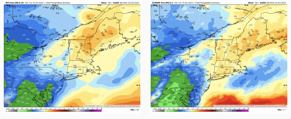
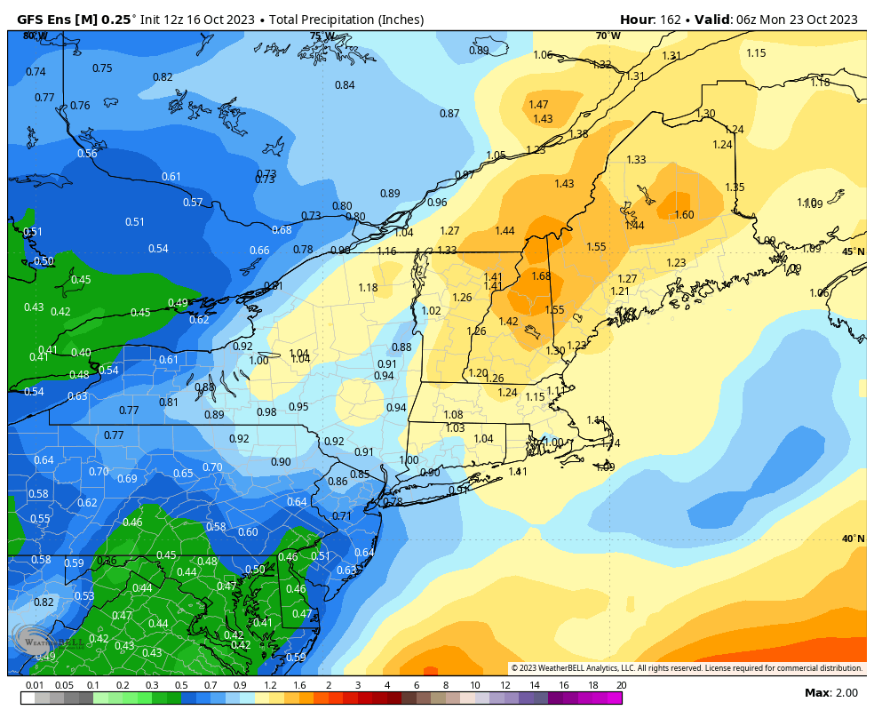
Rainfall amounts remain low for the beginning of the week, but this weekend could bring substantial rain to the Northeast. While there’s not great consensus on the evolution of the system (mostly due to the fact that there are multiple lows), there’s decent agreement on how much rain is going to fall from Friday evening through Sunday night.
This image is total precipitation through Sunday night, which does take into account the light rainfall through Tuesday…which is only .10-.20″. Therefore over an inch of rain is possible in ME, NH, VT, MA, RI, CT and all but western NY.
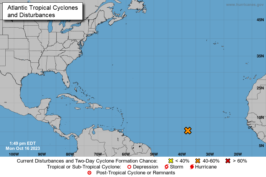
We’ll have another cool down behind this coastal system, but nothing overwhelming cold. As of now, I don’t see any major cold coming down the pipeline. This is not surprising as the tropics remain active (though starting to cool down).
The area of interest is expected to form a tropical system within the next week, though it will likely stay out to sea. Therefore I don’t anticipate any prolonged cold until this moves far off in the Atlantic, which puts us toward the end of the month.