Though cooler air settles in for the first part of next week, we’ll have moderation toward the midweek before a couple more storm systems start to ramp up. There are a few to watch – around 3/23, 3/25 and 3/28. The NAO stays close to neutral (therefore not much blocking of cold air) for 3/23 but moves negative thereafter.
The ENSO cycle remains neutral right now after quickly moving out of the La Nina space we had been in for nearly 3 years. An interesting feature is that it was in those moments we were seeing the index climbing toward neutral ENSO (near zero), that some of our major snow events occurred this season.
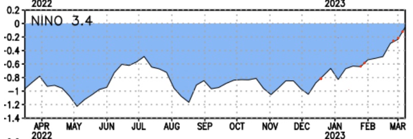
In December, we saw a system come through the week before Christmas and right around Christmas – notice the steep climb up. Then we quieted again as the ONI index leveled off and went back down. We had a series of winter systems after MLK weekend, then index again begins to climb. The pattern flattened as the index flattened for the first part of February, and then picked back up February break and into early March. While there are no concrete correlations between the ENSO cycle and Northeast winters, there’s certainly more mounting evidence that La Nina patterns can hamper storm patterns with significant blocking (cold air availability).
Moving into the next 7-14 days, there’s some discrepancy between the Euro & GFS.
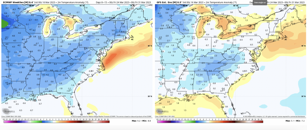
The overall 500mb pattern between both models are similar, so I’m not sure why the discrepancy is there. We are not in a southeast ridge pattern, which is one of the few where the GFS thrives, therefore I’m going to lean more Euro on this.
While it shows temperatures 1-3 degrees below average, our average temperatures are climbing quickly at this point in the year.
Therefore it may not be terribly “cold”, but certainly cool for this time of year.
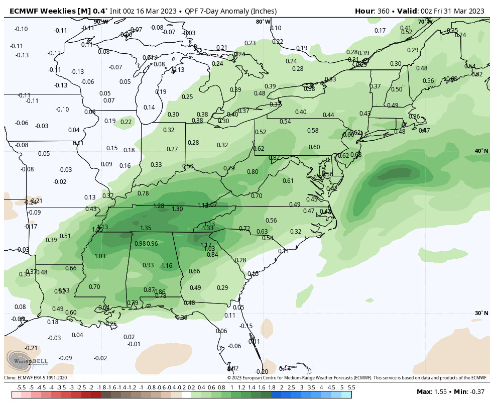
Another indicator that aligns with our three storm signals – the precipitation anomaly of both models is above average.