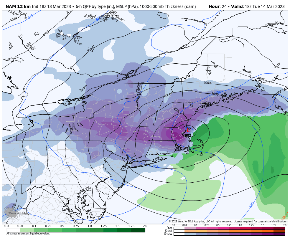
The week ahead has two storm systems to impact the east – one coastal system to affect the Northeast and one inside runner that is more impactful to the Great Lakes.
The coastal system moves in later today with mostly snow expected from the Poconos up through northern Maine. The heaviest snowfall is expected in the Catskills, Berkshires and southern Greens.
Any rain in the beginning of the storm eventually turns to snow. The quality of the snow will be dense, and therefore some potential damage is possible with tree branches coming down, power outages, etc. Wind will also become rather gusty behind the storm system.
Amounts will rain from over 2 feet in the jackpot zones to 3-6″ closer to the Canadian border, though wrap around snow showers will add several inches to the northern zones.
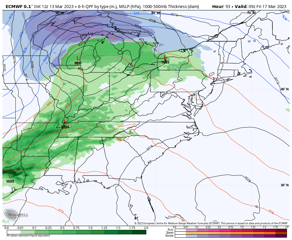
We start to see some moderation in temperatures heading toward the end of the week as our next system gears up. Low pressure moves into Michigan Friday morning with rain/snow expected with a sharp cold front following.
By the time this moves east, some cold air damming tries to keep some wintry precipitation in the Northeast, but still a bit unclear. The NAO is negative, which indicates some blocking possible, so some wintry precipitation isn’t out of the question, however given the strength (and still some uncertainties) with the system moving through Tuesday/Wednesday, the models may be having some trouble figuring out the nuances of the later system.
Much colder air comes in behind this front and lingers into early next week.