It seemingly took forever but this is the first week that the ONI Index is ENSO neutral. It’s the first time we’ve been here for nearly three years. Better late than never, but it would’ve been nice for this to happen a month ago…
The effects of transitioning to ENSO neutral have already been seen in the pattern, as we see a negative NAO taking hold, along with a negative EPO/WPO by Saturday. And while this is beyond the week ahead, the PNA should be turning positive around mid-month, which means we have the ingredients for quite a March winter rally on our hands.
In terms of the week ahead, we have three systems that pique our interest. Overall, temperatures are around average, with the exception of the southern Mid-Atlantic where the warmth hangs on just a touch longer.
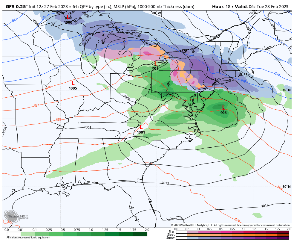
The first system is somewhat of a disjointed coastal system affecting the entire Northeast and the northern Great Lakes. I’m sticking with the GFS as it typically handles SE ridge patterns better.
Accumulating snows are expected from the Hudson Valley, even portions of the Poconos and north. However amounts will taper off toward the Canadian border.
Late Wednesday into Thursday we have a quick hitting clipper system that will likely bring multiple precipitation types to New England. A coastal low develops a little late in the game but helps reinforce some cold air ahead of the next system.
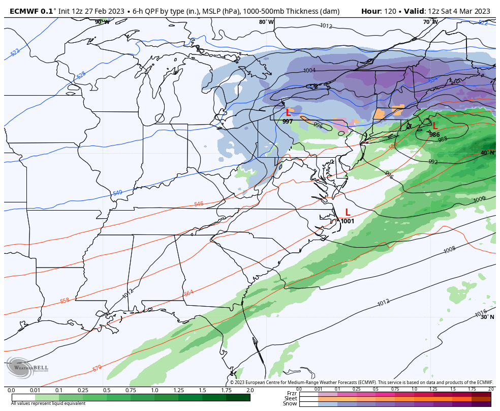
The biggest storm on the radar is going to be Friday into Saturday. This has all the ingredients to be one of the more major storms of the season, but with the strength of a coastal low also comes the concern of mixing.
At this point the SE ridge is being ejected into the Atlantic, so I’m more middle of the road when it comes to GFS vs. Euro. Both have the low pressure near the 40/70 benchmark but the GFS is bringing in quite a bit more mixing. Usually with a storm at the benchmark, we have enough cold air to circulate in, therefore I’m thinking there’s some discrepancies coming through in the feedback of precipitation type, or the low is being misplaced and is perhaps inside the benchmark. We are in a pattern transition, therefore having some contradictions within the model is not surprising.
There’s still plenty of time to flush out details on this one…the energy associated with it comes onshore Tuesday night, so it should be well captured by the Wednesday morning balloon launches. Cold reinforces behind the system for Sunday but not to arctic levels.