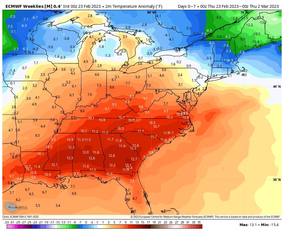
The overall trend is a cooler March for most; though it’s a bit tumultuous to start. In the next 7 days, we’ll have a fair amount of warmth from the Mid-Atlantic and south with the southeast ridge in place. Notoriously, the GFS handles the southeast ridge better than the Euro, therefore I’ll be hedging my bets a little more on the GFS. We’ll have somewhat below average temperatures in southern New England to well below average temperatures in northern New England. The precipitation anomalies remain above average in the region, with the exception of far northern Maine. Right now there are two storms to watch – Tuesday and Thursday.
For the following week, Days 7-14, the temperature anomalies fade a bit, evening out if you will. This is a sign of recharge in the dominant pattern, which is a showcasing a negative NAO, and a transitioning positive to negative EPO/WPO. These are good signs for a fruitful March.
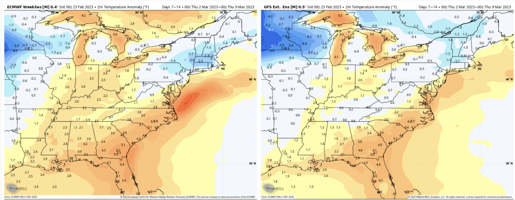
Notice the GFS is a little more on the fence with any anomaly, more middle of the road. This is the SE ridge dying out, with some warmth being pushed to the coast. The EPO/WPO turn negative around March 6, which is in the middle of this time period. Therefore I’d expect the latter part of this 7 day time frame to feature more of the cold end.
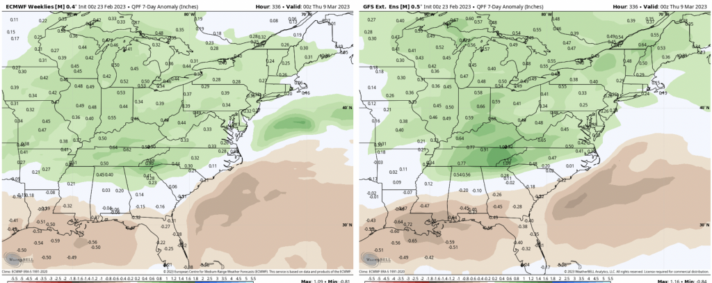
With a deepening cold trend, an above average precipitation trend could bode well for late winter snows.