The warmth is behind us after the strong cold front came through Friday. This coming week will be more of a transition week before we start seeing a colder pattern settle in. We’ll have a couple quick systems come through, followed by a strong system Thursday/Friday which will be a mixed precipitation event for most.
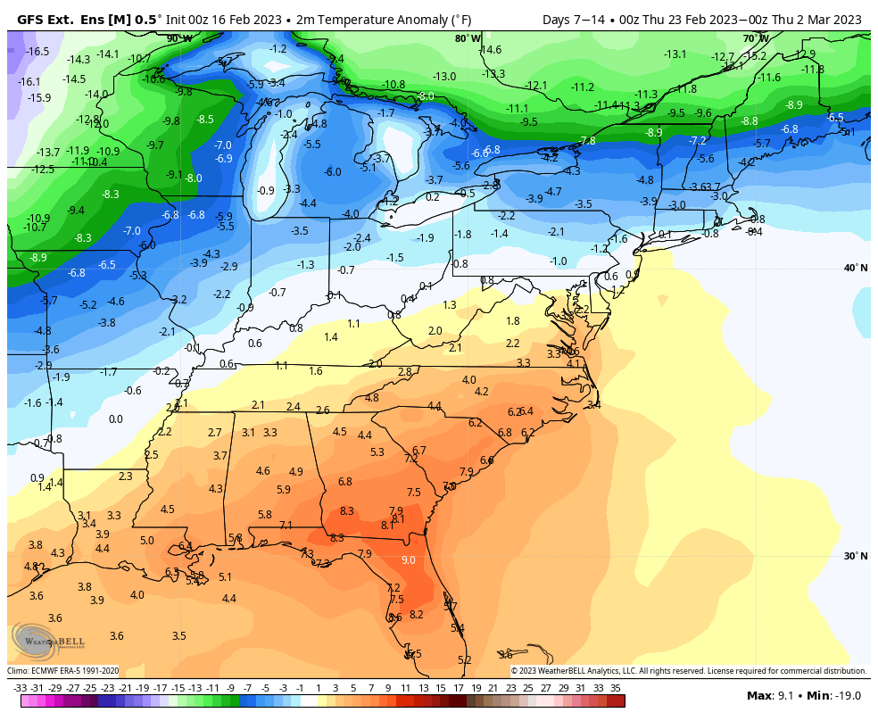
Beyond that, we have a significant cool down, which there is decent consensus on across the models.
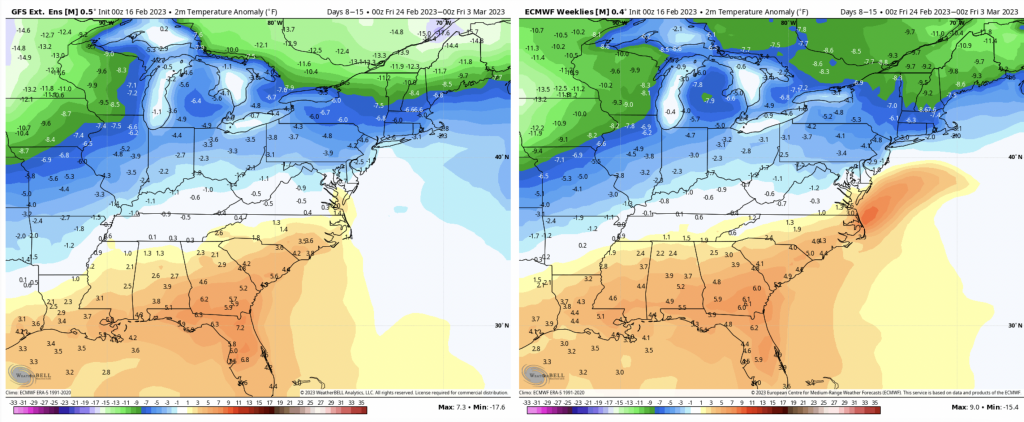
Below average temperatures are expected as far south as Virginia in this time period. In the same time period, we have average to above average precipitation amounts expected from the same model output. That would indicate that the late winter snow machine is picking up.
As we’ve been talking about for a while now, the late winter is going to be more fruitful. With La Niña continuing to lose its grip (last ONI index was -0.5C, which is the minimum cutoff for a weak La Niña), global patterns are shifting. The next ONI index comes in on Monday, and may be the first to indicate a neutral ENSO cycle in nearly 3 years.
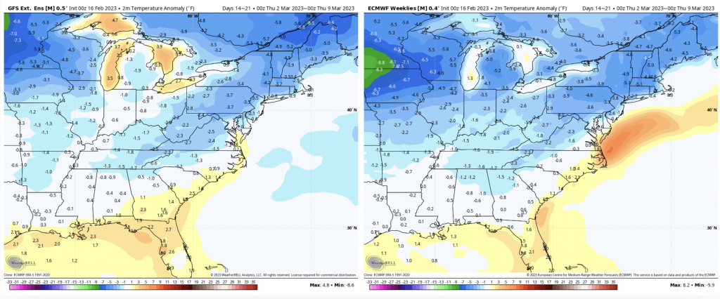
We’ll see another week block of below average temperatures into the following week, this time stretching down toward the southeast, while precipitation anomalies remain above average. Overall, the late season is looking promising.