This week will ultimately be the warmest week that we have through the month. Two cold fronts come through – the first of which has already passed through the Great Lakes and will arrive in the Northeast Tuesday. We’ll see a weak low pressure develop offshore Tuesday, prompting some light snow showers early Tuesday morning that linger through the day in New England. Otherwise it’s just somewhat noticeable by a (briefly) cooler midweek.
We warm up quickly as a warm front crosses through on Wednesday with some sporadic showers/drizzle. Thursday will be a warm day across the eastern half of the US before the second cold front pushes through Thursday night.
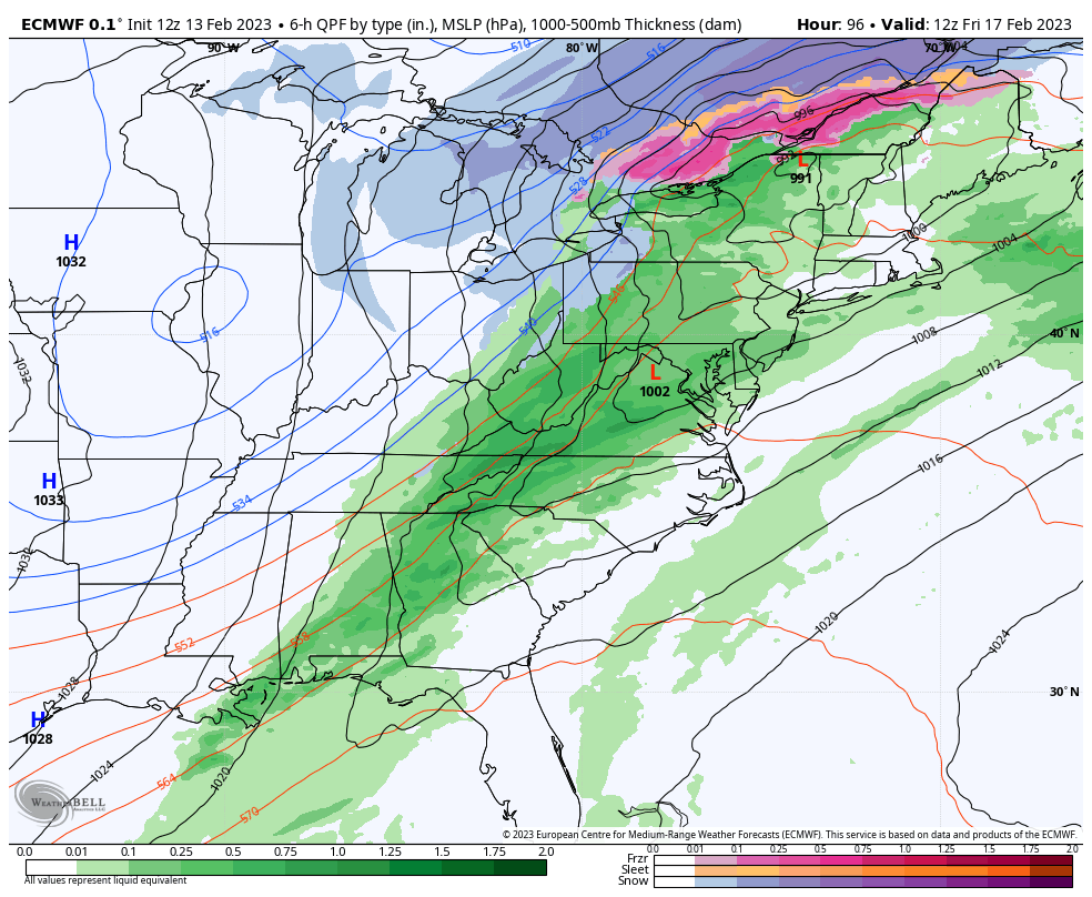
The track of the low is favorable for the northern Great Lakes with some accumulating snow expected (after a little rain), but mostly rain expected in the Northeast, somewhere in the range of .25-.50″. As the cold air plunges in, we’ll see rain turn to snow showers in higher elevations, but may not make it to base areas/lower elevations. Temperatures drop Friday and we flash freeze into Friday night. Saturday will be cold but we moderate quickly for Sunday. Wind will also be elevated in most areas for the weekend.