There are two systems that we’re watching for the week ahead, along with several non-diurnal temperature changes.
While the Northeast is cooling off more substantially than expected Monday night, we’re starting to see warming ahead of a cold front front in the Great Lakes and just getting into the Mid-Atlantic. Some summit areas in New England may also begin warming before sunrise Tuesday as well.
There’s a weak area of energy riding along the boundary, which brings light rain/snow showers to the Great Lakes on Tuesday, and getting into the Northeast Tuesday night. Temperatures drop after the precipitation departs, which brings about “cooling” (or steadying) temperatures during the day Wednesday.
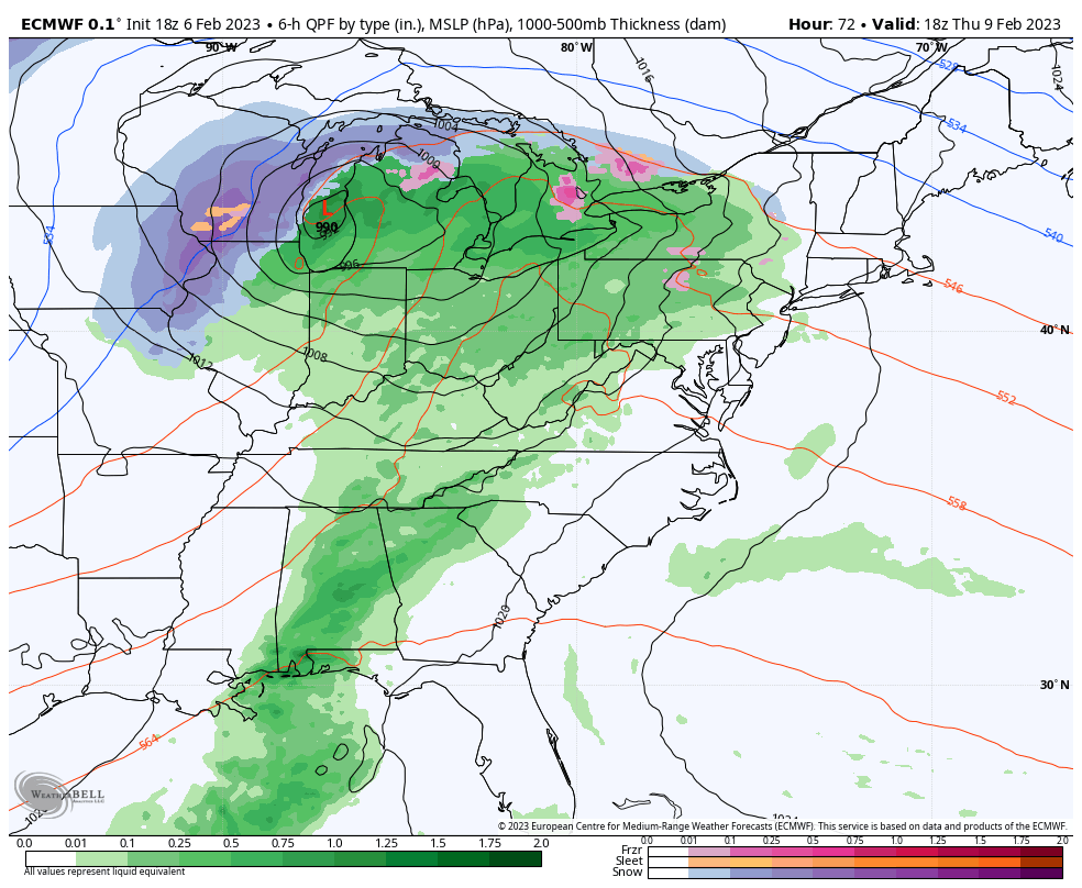
The next system gears up Thursday with low pressure moving through the Great Lakes. It’s mostly a warm system with the exception of northern MI & New England, where we’ll start as snow, change to ice and eventually some rain as temperatures warm Thursday evening. This is mostly for upstate NY, VT, NH and ME. Otherwise we’ll be seeing rain. A secondary low develops behind this system for Saturday, however at this point it looks like the low stays too far offshore to bring precipitation to the east. We’ll cool down briefly into Sunday before we moderate again into early next week.