It’s been a mixed bag of everything over the last couple of days, but we’re gradually moving toward a somewhat cooler pattern. We’ll notice this more in the last week of the month, which has been the focal point for a pattern change.
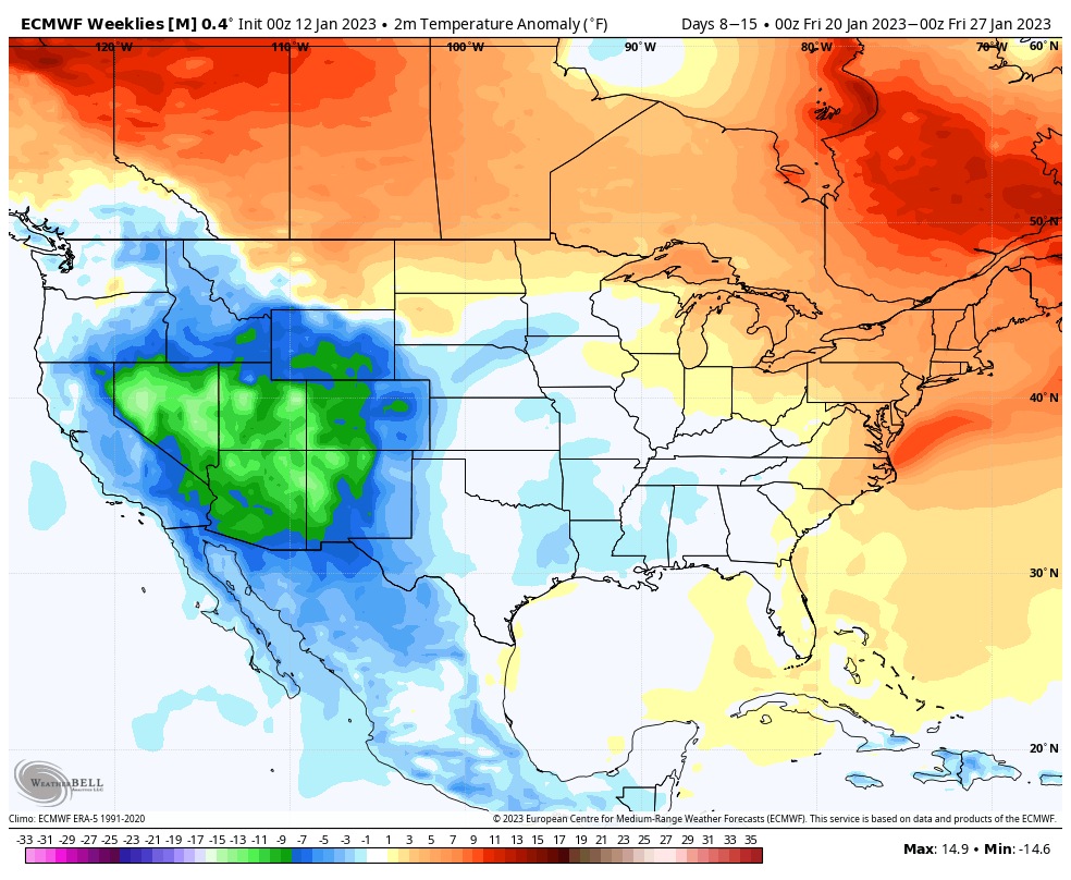
The good news is that from last week’s blog to this week’s, the surface temperature anomaly for 1/20-1/27 has come down a couple of degrees in the east. We are seeing the influence of cold gradually spreading from west to east, and this will all be part of an overall pattern change.
What we’ll notice into this time frame is a very active pattern. While we may still see some multi-precipitation type storms, or snow to mix, mix to rain scenarios, we should see the temperatures range cooler and cooler with each one.
However, we’re not going into an arctic blast – which is good. The farther we go in one direction, the more likely we’ll flip to the other direction. Therefore to keep “seasonably cool” temperatures provides greater stability for the pattern and its sustainability.
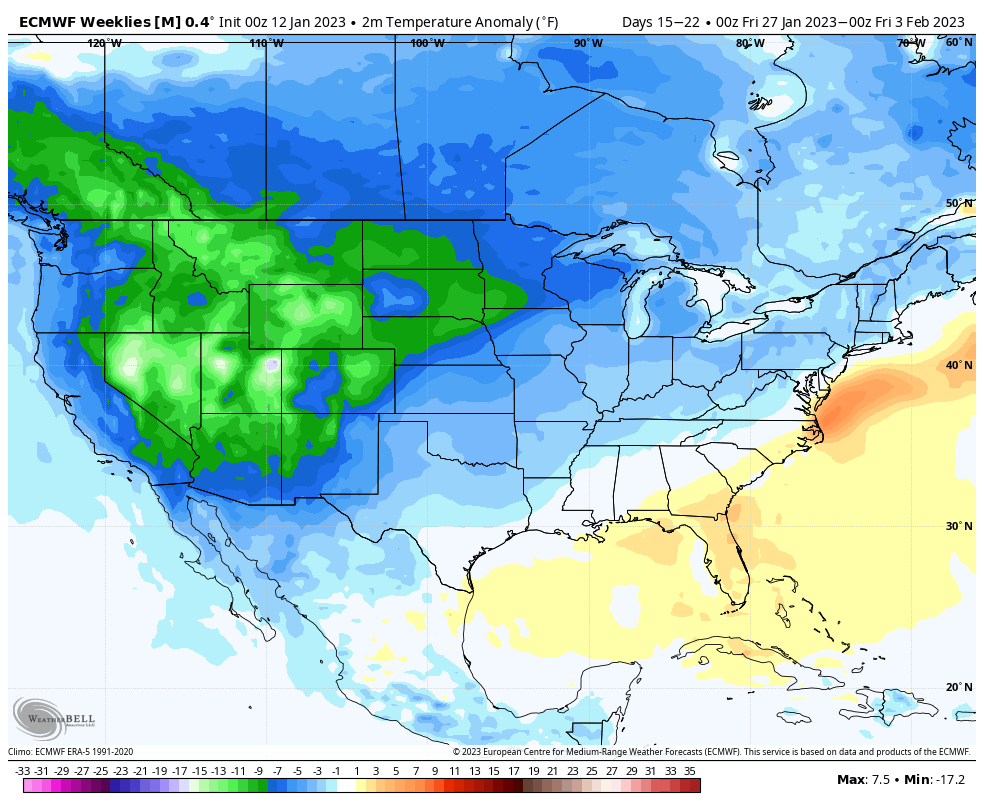
Looking at the temperature anomalies for the following week, there’s some interesting features.
First, the majority of the U.S is colder than average – however the core is centered in the west and stretching toward the Great Lakes. With this pattern, I would expect more Alberta Clippers than large mid-latitude systems to impact the Great Lakes/Ohio Valley.
Second, notice the warmest spot – just off the Delmarva. This is the breeding ground for coastal storms and formation just off Cape May is typically a favorable track. Sometimes it can follow the warmth – which would provide more snow for the Mid-Atlantic and southern New England before going offshore – and other times it can be blocked and forced north toward the 40/70 benchmark.
Our blocking indicator, the North Atlantic Oscillation (NAO), is going negative after 1/20 (but not very negative). These are some solid signs that point to more promising end of January/beginning of February.
The Arctic Oscillation (AO), which I often call the “keeper of the Polar Vortex”, stays roughly neutral – that is good because a strongly negative AO can shunt storms south, and force a strong reaction to warmth.
We knew January would be a volatile one, but I think we’re starting to see the light at the end of the rainy, warm tunnel.