After a little taste of more winter-like conditions the last few days, we’ll stay in a relatively stable pattern through the week. Next time frame of concern arrives around 1/14 and 1/15 as models are indicating another strong low pressure system.
Right now it’s too early to tell how this will evolve, however the NAO (North Atlantic Oscillation) is positive, which isn’t a great sign for an all-frozen event. If the track is favorable then the +NAO is less of a concern, but it’s still too far out to see those details.
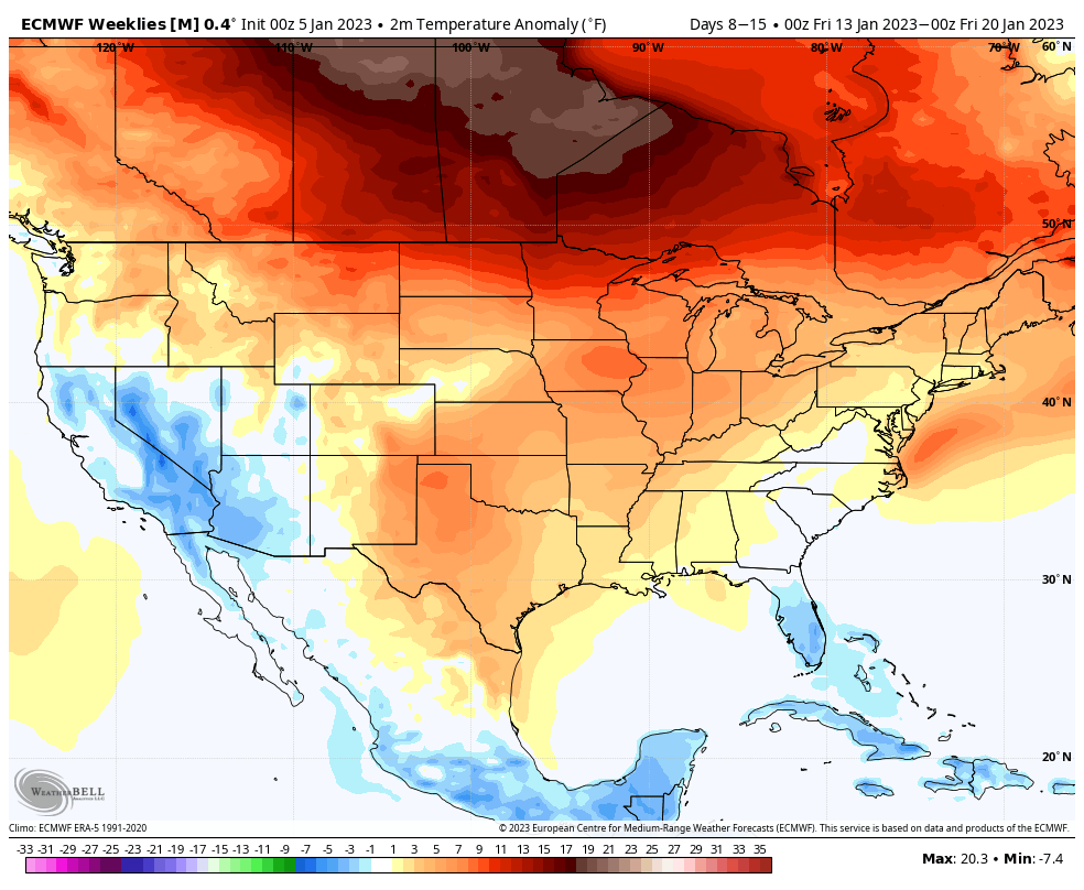
Heading through MLK weekend and the days following (Days 8-15), right now the pattern remains focused on a re-deepening of the western trough, which does not provide a lot of cold air mass opportunity for the east.
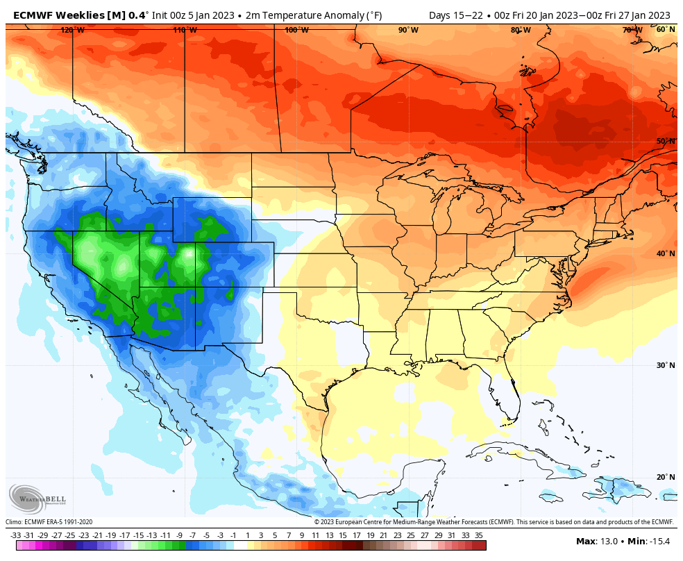
Temperatures look to peak in this current warm phase around Days 13-19, with some cooler air signals returning toward the last 7 days of the month.
Just a note, these are average temperature anomalies in a 7 day period, which means we could have average or below average days in there.
The AO (Arctic Oscillation) remains negative for the next 2 weeks which means there’s cold air around.
The NAO is slightly positive to neutral until ~Jan 17-20. The PNA (Pacific North American Oscillation – which is a good teleconnection for storm signals), goes negative after the storm 1/15 for about 5-6 days before running back positive around Jan 20.
While this seemingly looks like a negative long term update, it’s not a blow torch of a forecast. We’ll see constant low amplitude troughs and valleys, rather extremes in either direction.