We’ll see a bit of a transition heading into next week, coming out of it in a cooler, not cold, pattern after another spike in temperatures Tuesday and Wednesday. We’re not quite seeing the eastern trough develop like we did prior to Christmas, but rather a SE trough developing into the middle of the month.
The Arctic Oscillation (shows how much cold is available) and the North Atlantic Oscillation (determines the level of blocking) both trend negative into the end of next week. The GFS is a little faster with it than the Euro, but overall we should be heading into a more favorable period for natural snow and cool air masses, though not overwhelming cold.
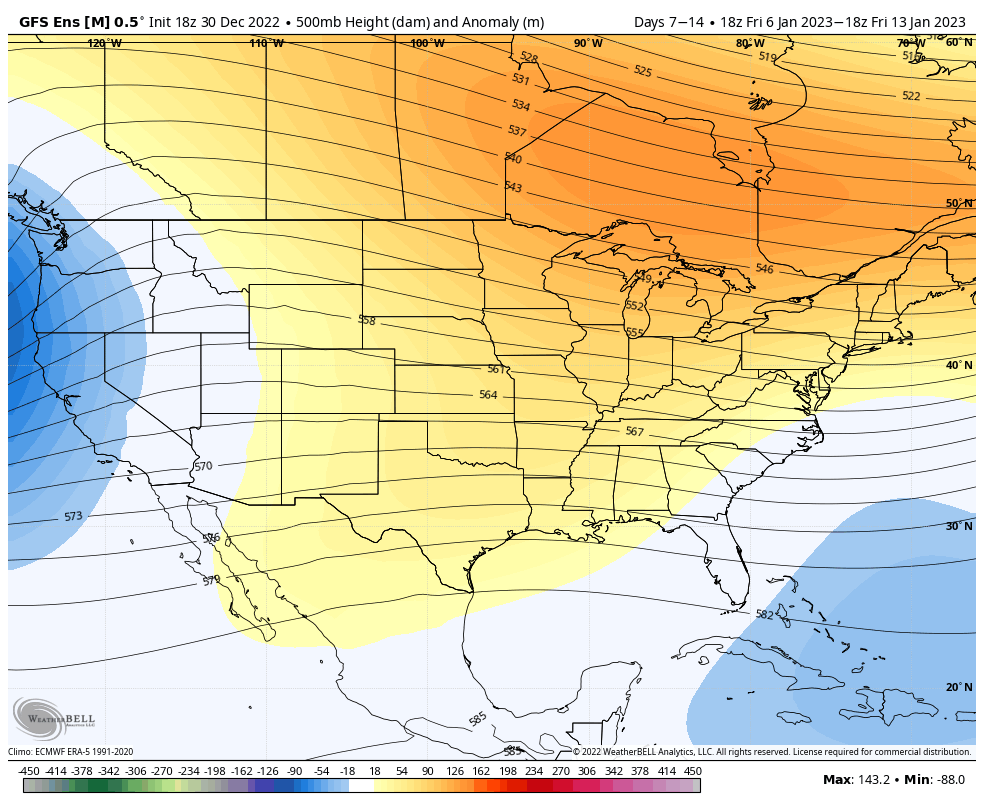
In the height anomaly posted, you can somewhat visualize the storm track, which is an active one through the middle of the month. Energies come out of the Midwest, dip south, and track northeast with the possibility of merging with something in the southern stream and coming up the coast (thanks to the trough developing in the SE).
Therefore the overall pattern is cool, but not cold, and should remain active through the MLK holiday weekend.