We are moving out of the cold pattern through the next couple of days…
An elongated front draped over the Great Lakes brings a few rounds of snow showers to the Northeast during the midweek, in addition to some accumulating snow mixing with sleet for the northern Great Lakes Tuesday night – Wednesday as we transition into a warmer pattern.
For the Great Lakes and New England, I wouldn’t call this transition phase very “warm”. We will have some rain events and remain above freezing for most days, but we’re not swinging to the 50’s and remaining there for the entire warm up (perhaps a couple days before the pattern flip). The Mid-Atlantic will likely see more days in the 50’s, especially heading into the first week of the new year.
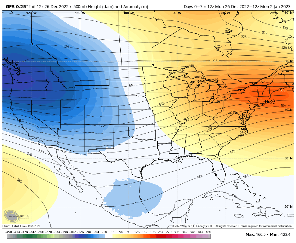
The 500mb height anomaly shows the center of the ridge over New England, therefore we’ll likely see storm tracks remain on the “inside runner” route until we see that shift. The first significant rain event is likely to come on New Year’s Day – there will be a brief, shallow cool down behind it but the overall pattern doesn’t adjust until the following weekend.