A quick update on the system; it’s over-performed in the Catskills, Adirondacks, and the central/southern Greens and otherwise been fairly on forecast…certainly more of a Northeast system while the lake effect snow machine kicks up in the Great Lakes. We’ll continue to see the snow diminish from west to east throughout the weekend in New England.
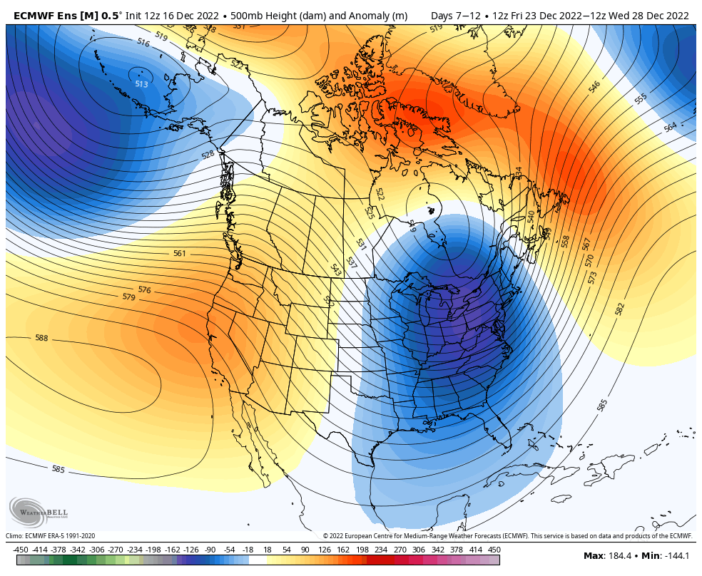
There’s actually not a bunch to talk about in the long range since the cold holds for quite some time for the eastern half of the country.
We have a deep trough that’s going to develop with plenty of cold air coming in, and a cold Christmas week expected. This eastern trough is in a position that supports an active weather pattern along the east coast, while we lock in the cold in the Great Lakes.
Therefore we should be seeing plenty of snowmaking opportunities in all regions and even some more natural snow. The next system arrives 12/23 but track is still a bit uncertain – there is a possibility of mixed precip/rain if it becomes more of an inside runner. The pattern does not support this – it’s actually more likely that the blocking shunts the storm offshore/to the south than to be an inside runner.