A few quick notes on the short term before we get into the long term…
*Current air mass – mostly for New England areas – you may have noticed that there have been dry layers moving into different parts of the mountain today. This will likely continue into Saturday, and it can be very sporadic and hard to predict. At one mountain today, I saw 85/22/55 as the humidity levels from top to bottom. Dry air masses have the ability to move temperatures in either direction quickly – inversions come and go, sometimes summits can pop up 5-6 degrees in a hour. These are very microclimate events that are hard to capture in the forecast beyond warning you, since those movements can happen within the 3-hour time frames. I thought we’d see summit temp spikes last night, but it only occurred at two mountains. I realize most are snowmaking north of the Mid-Atlantic so I’ve been hedging temperatures on the higher end to err on the side of caution. However, the one silver lining is that temps won’t spike without humidity dropping, so even if you see the temp spike, you’d likely remain in the wet-bulb threshold. Just wanted to explain my rationale there.
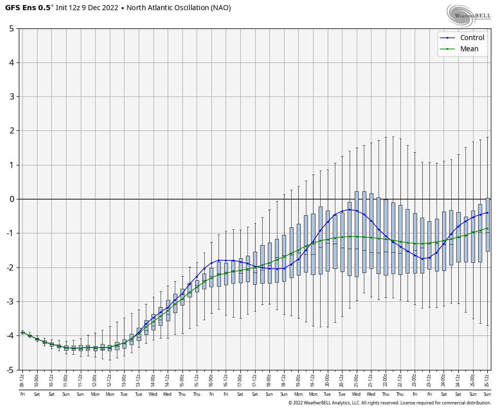
*Storm system 12/15-12/16 – as I touched on in the video yesterday, my concern is that the strongly negative NAO (North Atlantic Oscillation) would shunt the storm to our south. The GFS started to show that today while the Euro/Canadian still provide a significant system (and mostly snow, which we touched on yesterday would make sense in this pattern). We still have 6 days until this would be impactful to the Great Lakes/Mid-Atlantic, therefore I anticipate more changes.
Ok, onto the long term! We have some good news, which is nice to finally share. Behind whatever happens with the system next week, we’re likely to see temperatures drop and stay cool, which will be welcomed to all continuing snowmaking efforts but even more so to the Mid-Atlantic, who should get their first decent window of opportunity.
Though the blocking from our negative NAO may hold this system down, the clear trend from the image above shows it weakening into Christmas week. This should bode well for systems to be able to come through the Northeast (not shunted south) and keep enough cold for frozen precipitation.
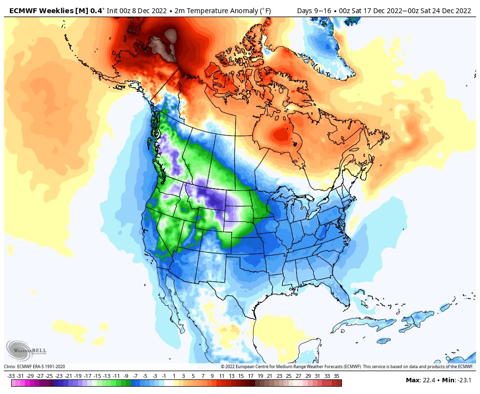
I decided to showcase the 7 day surface temperature anomaly this week to show the broader temperature picture of the overall pattern. For the east, our colder than average temperature patterns will be centered in the Mid-Atlantic, while it’s seasonably cool in New England. I still think this is a little underdone, but there are probably some outlier ensemble members skewing the mean a little bit.
I anticipate the week before Christmas to be active as the blocking lessens, and we start to see a rise in the PNA (Pacific North American Oscillation). The PNA going positive is typically a storm signal for the east. While it’s only getting to about neutral, we can still see some storms come to fruition.
All in all, it’s a decent pattern heading into the holiday weeks.