Cold air has finally arrived and will be sticking around the majority of the week. While the Great Lakes stay entrenched in the cold with snow showers throughout the entire week, we’ll have a couple ups and downs for the Northeast.
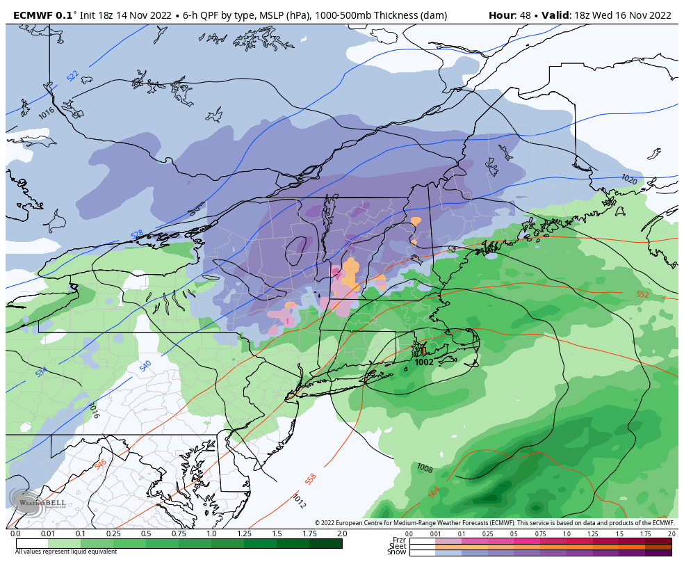
Monday remained cold, and we’ll only see slight moderation into Tuesday. We do see temperatures begin moving Tuesday night into Wednesday as a the first wintry coastal system gears up. We’ll see snow in PA and portions of southern/central NY as the low develops off the NJ coast – widespread 1-3″ possible.
There’s going to be quite a bit of mixed precipitation due to the track of the upper level lows by the time it gets to the Northeast. When low pressure tracks in the vertical aren’t stacked (same geographic position from the surface into the upper levels of the atmosphere), they can affect precipitation types and influxes of warm air, which is what we’re seeing with this scenario. The 700mb low is tracking farther west, which means in the upper atmosphere we’re seeing the track of an “inside runner” system, even though at the surface we have an ideal track near the 40/70 benchmark.
Therefore we won’t stay all snow in all zones, though the most likely spots to stay all snow will be northern NY, VT, NH and ME where 6″+ isn’t out of the question if track/temps workout ideally. Otherwise we’ll see decent impacts to snow amounts due to sleet/freezing rain mixing in.
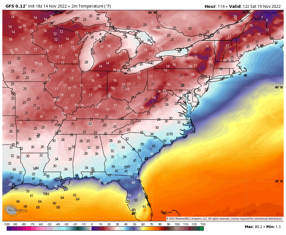
Another blast of cold comes in behind the coastal low and will keep us cold through the weekend. Check out the lows expected for Friday night into Saturday morning.