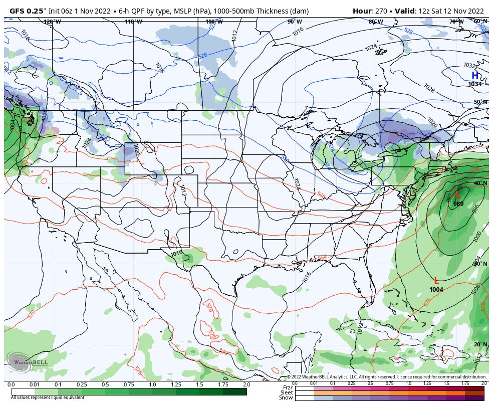
For the last several weeks, we’ve been talking about the active tropics creating volatility in the long term. Due to the weak handling of tropical systems by models, we tend to have high variability in model runs for Days 5+, and cold surges not coming to fruition. I wanted to show you the last 4 runs of the GFS at 8am Saturday, November 12.
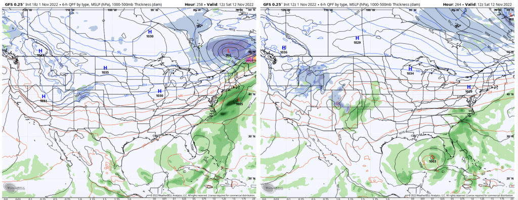
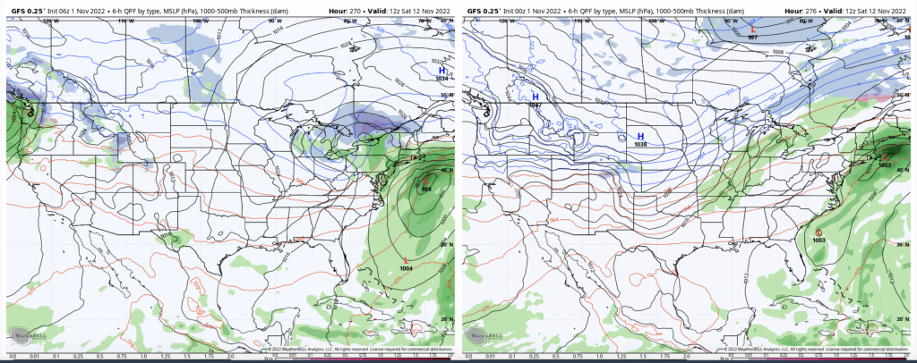
Several things of note: first, the tropical low. It’s all over the place in the Atlantic, and the 12z run today had it in the Gulf of Mexico. There’s also a northern stream piece of energy in the 6z & 18z runs, which if you followed the 6z runs, you saw a massive nor’easter (with a tropical component) develop in the models. And thus, the position of the high pressures, which is the ultimate deliverer of cold via northerly winds, is widely scattered from every end of Canada.
I wanted to place some visuals with the textual context I’ve been providing over the past couple of weeks. Cold pushes will develop and possibly come in next weekend, but the tropical variability is throwing a wrench in exact timing and details.